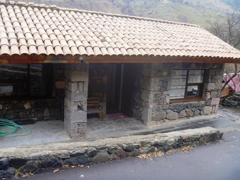
Calinawan Cave (Tanay, Rizal)

Calinawan Cave

Calinawan Cave

This natural, multi-level cave, part of several series of caves in the area, was said to have been discovered in 1901 (by a grandfather of one of the cave guides).  It was used as a local hideout by refugees during the Philippine-American War and by the Japanese during World War II.
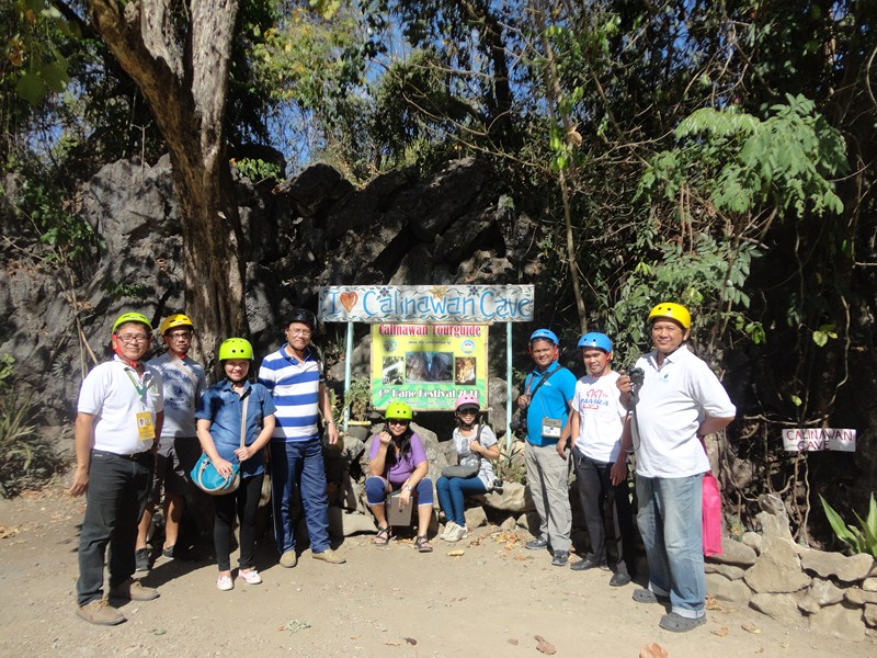
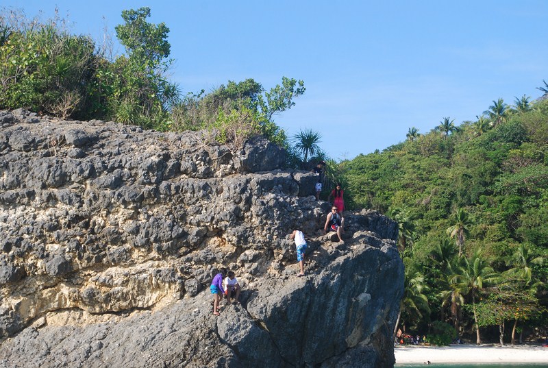
Calinawan Cave (2)

Media group

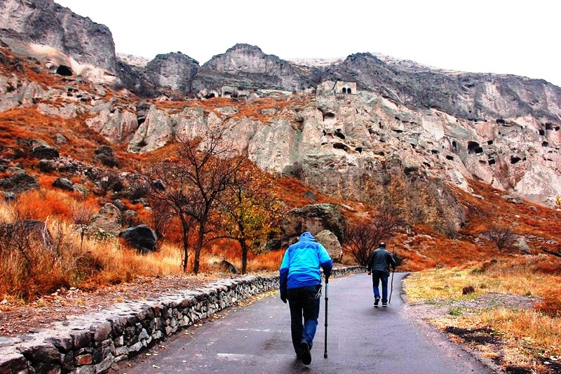
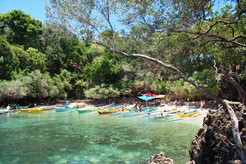
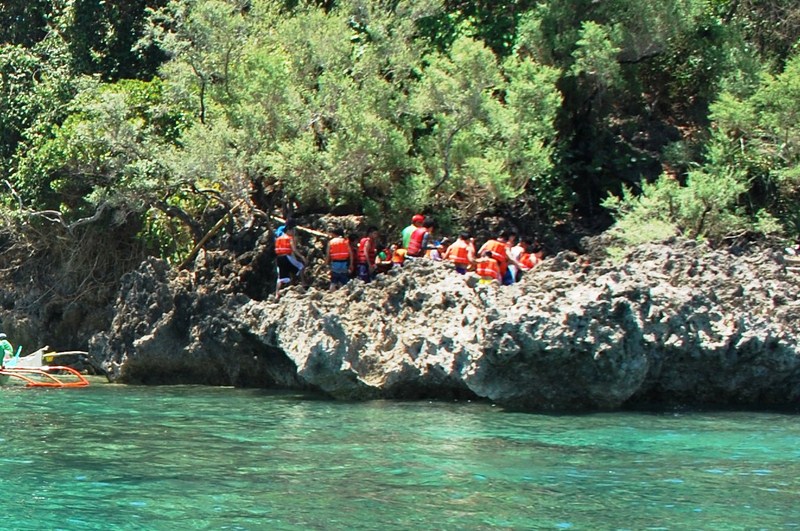
We detoured to this cave before proceeding to Daranak Falls. It’s a long and bumpy ride getting there since most of the road isn’t paved yet and the cave isn’t signposted that well.

Calinawan Cave (8)

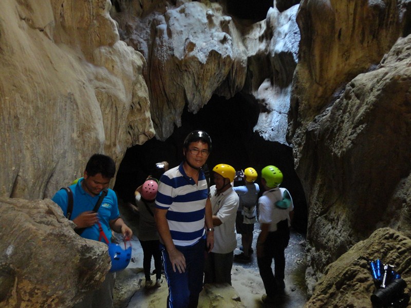
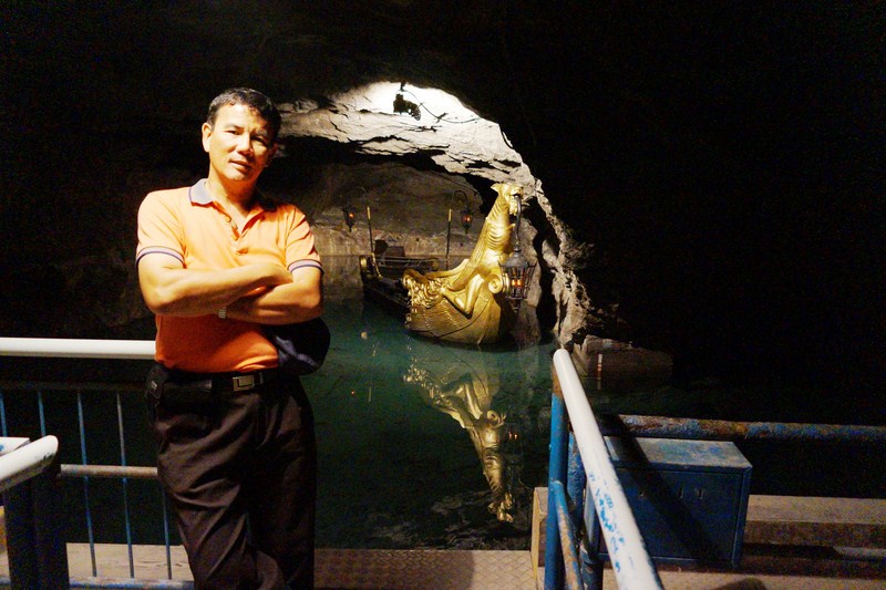
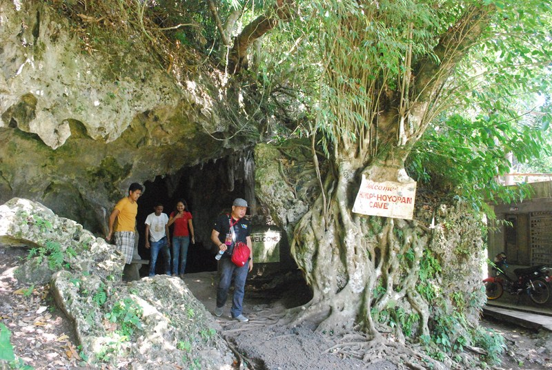
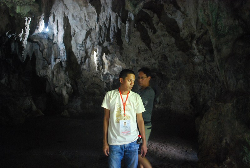
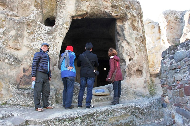
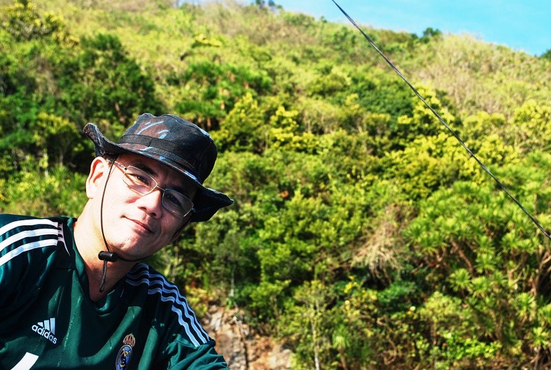
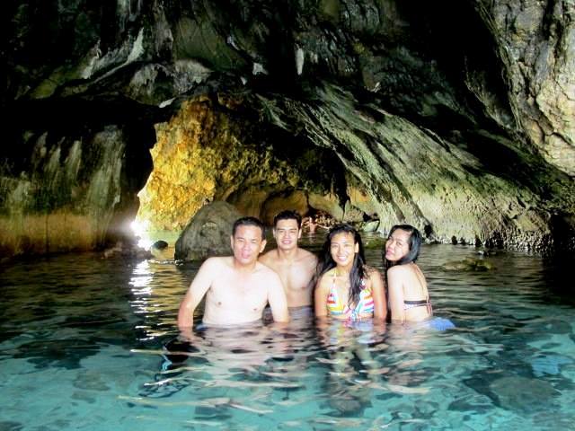
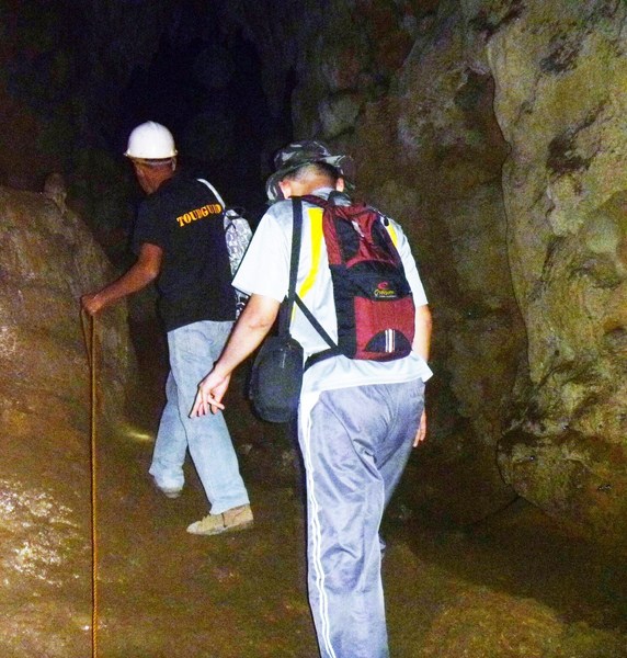
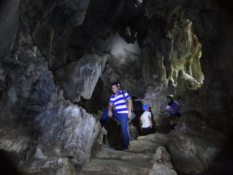
The author at Level 1

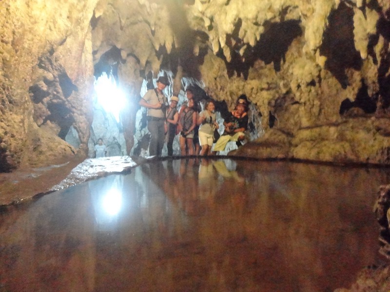
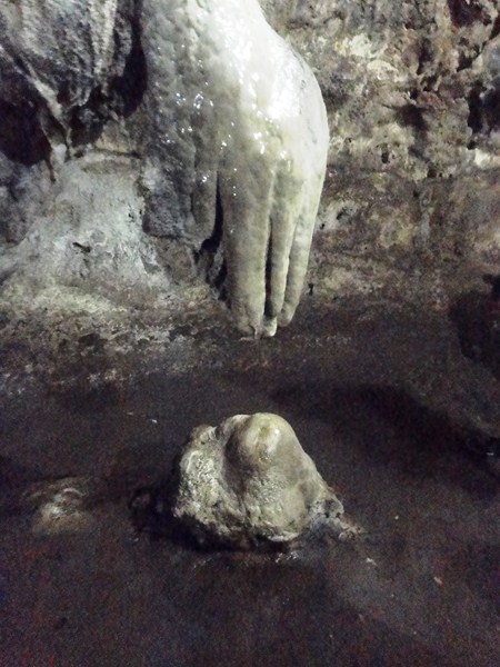
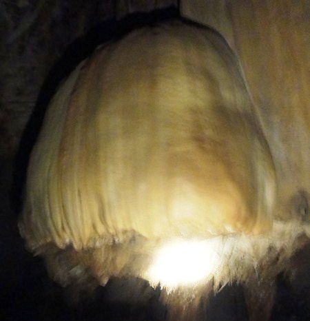
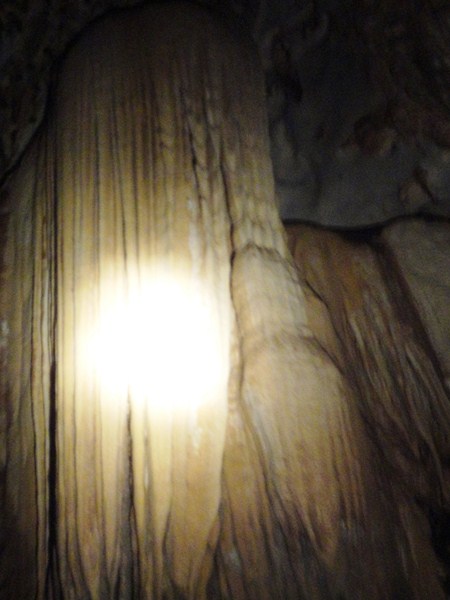
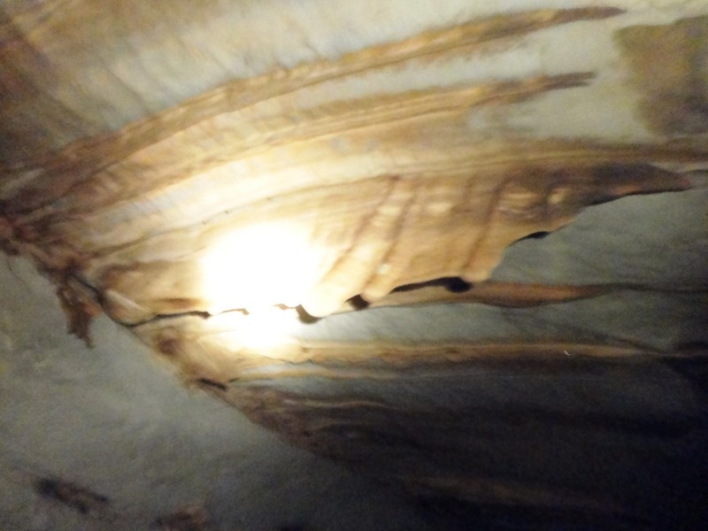
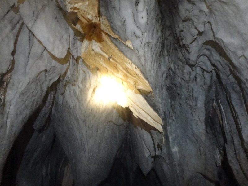
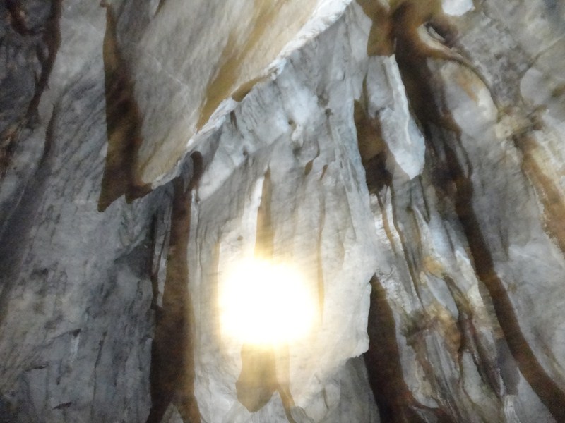
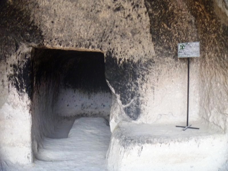
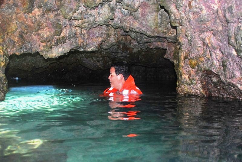
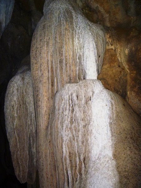
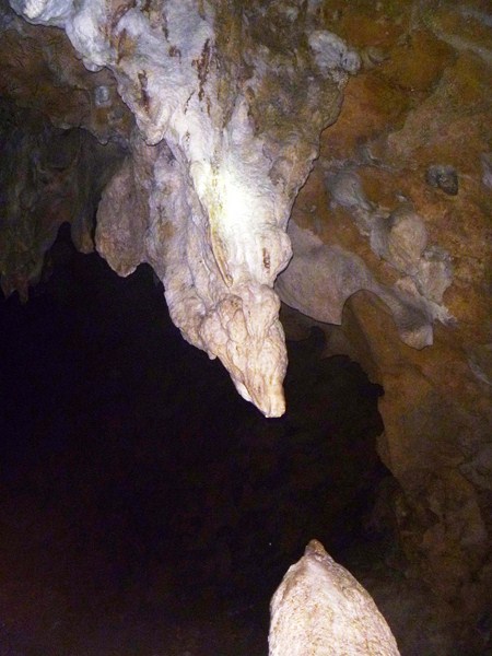
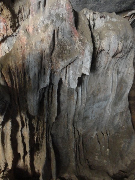
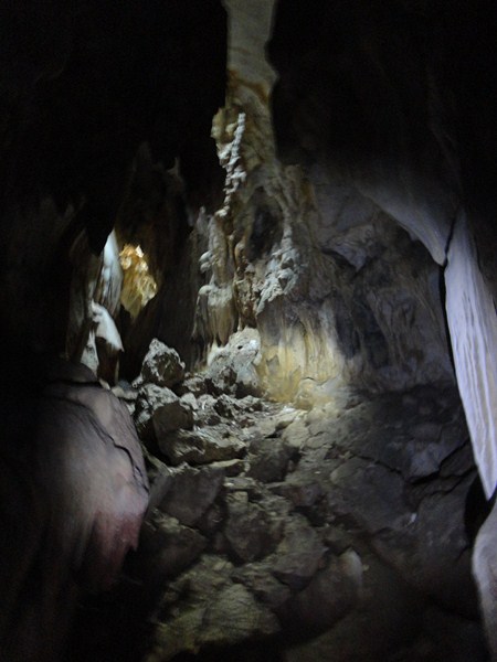
This cave is mostly dry and many of the stalactites and stalagmites, though still impressive, are dead. The cave’s name was derived from the word linaw (clear).  During the 15th-18th century, opposing parties used to convene inside the cave to settle disputes.  It’s a long cave system with different levels and openings.
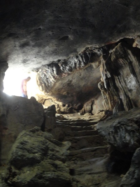
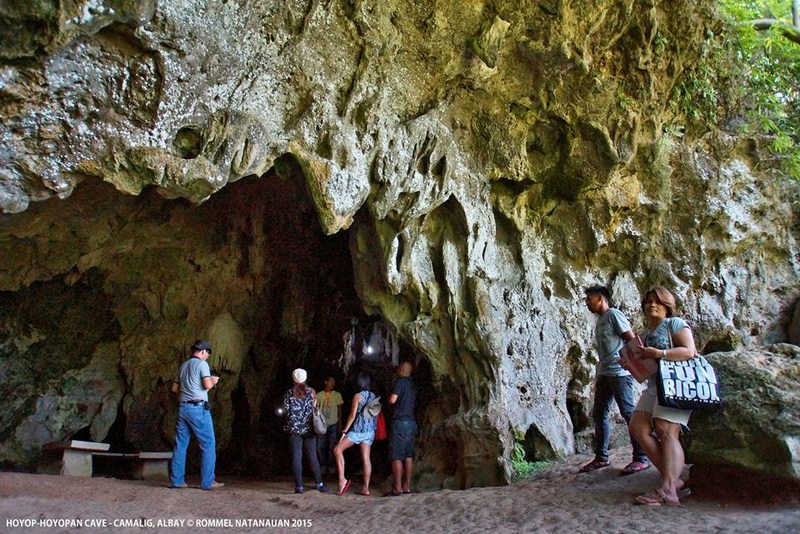
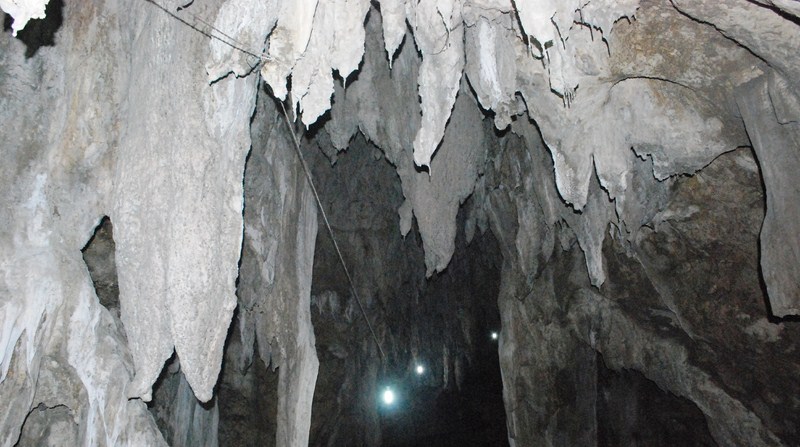
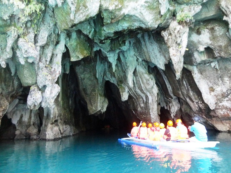
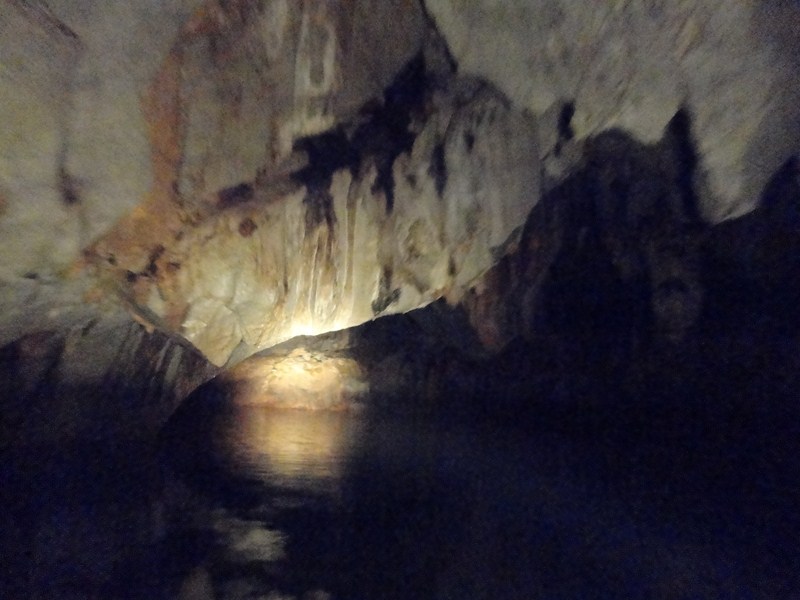
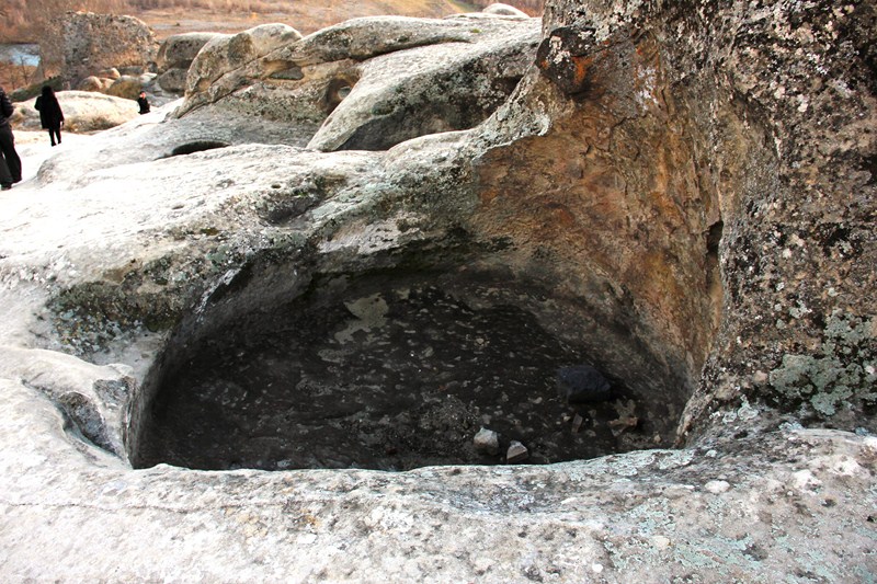
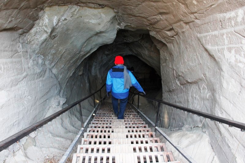
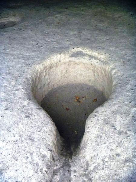
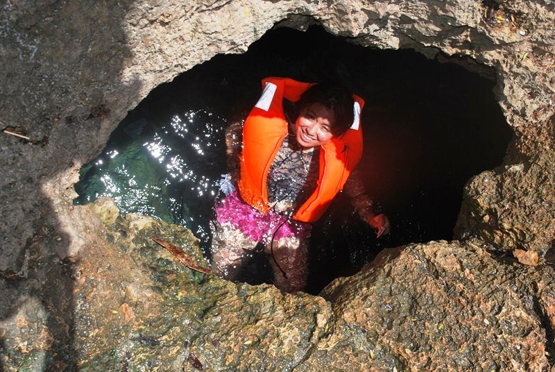
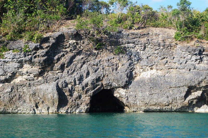
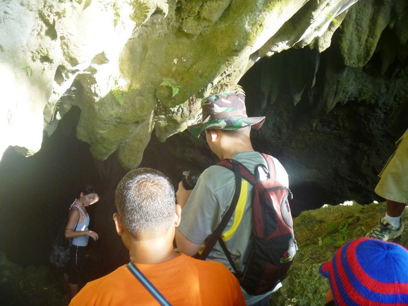
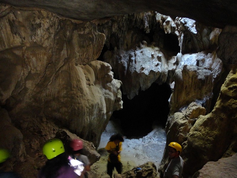
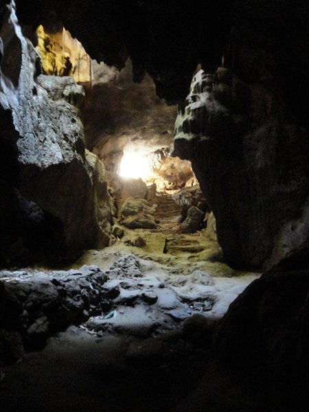
The cave opening

The cave opening

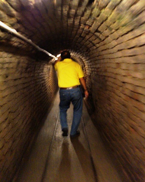
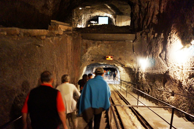
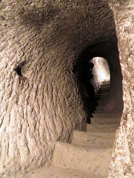
This cave has 7 levels but most visitors only explore the first two levels. The less visited and seldom explored Levels 3-5 are more challenging to explore as you may need to get your hands dirty.
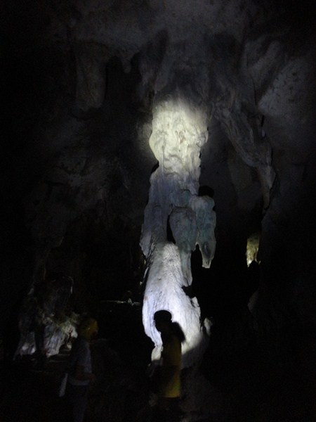
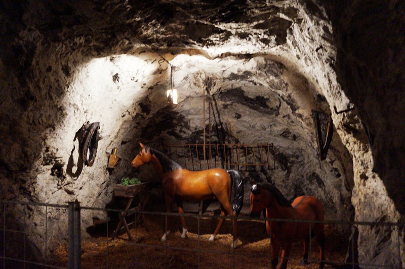
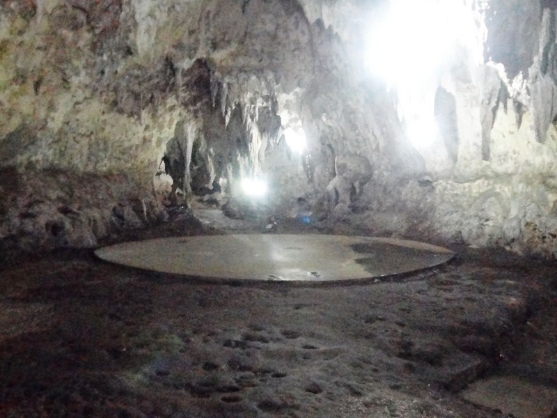
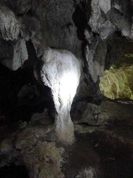
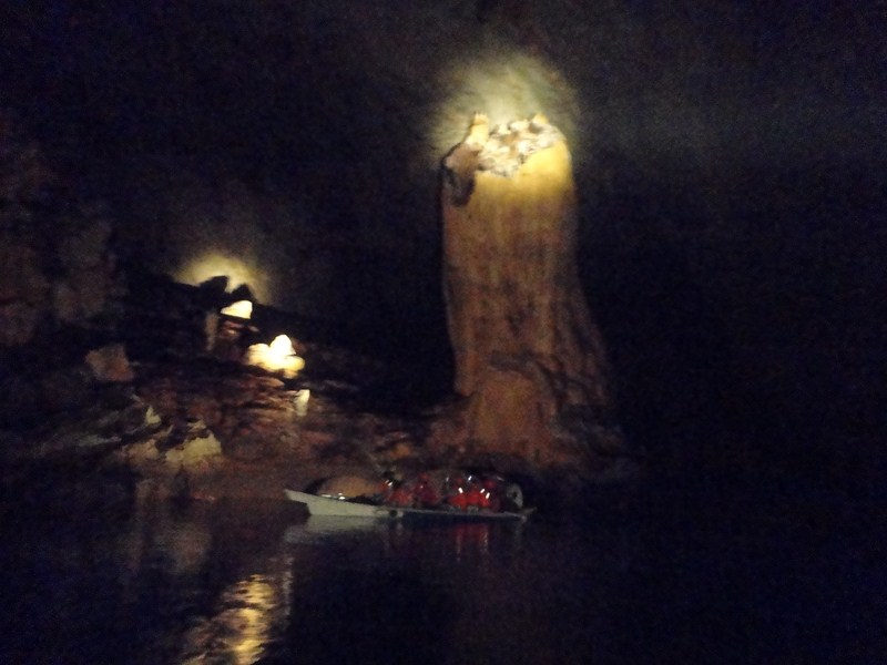
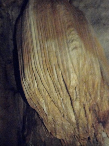
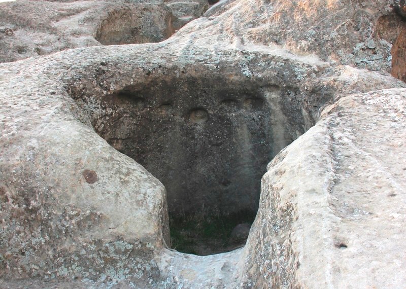
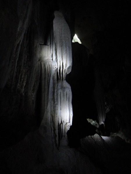
Calinawan Cave (23)

An eerie column

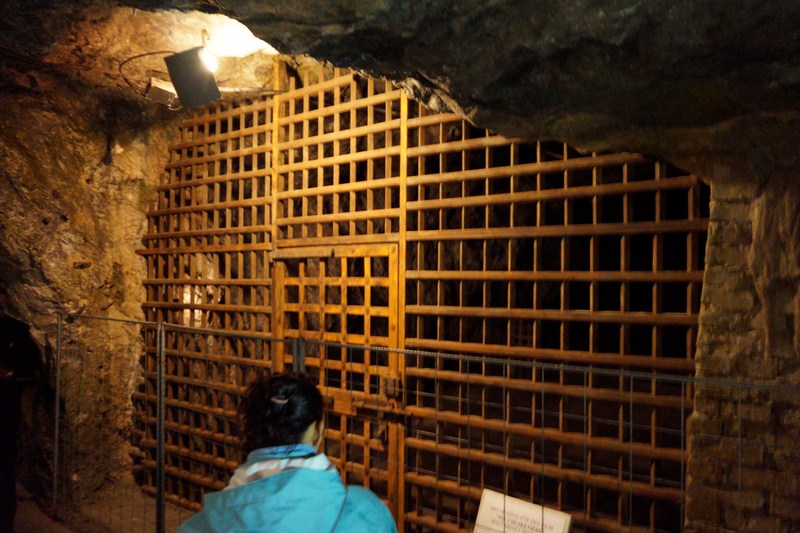
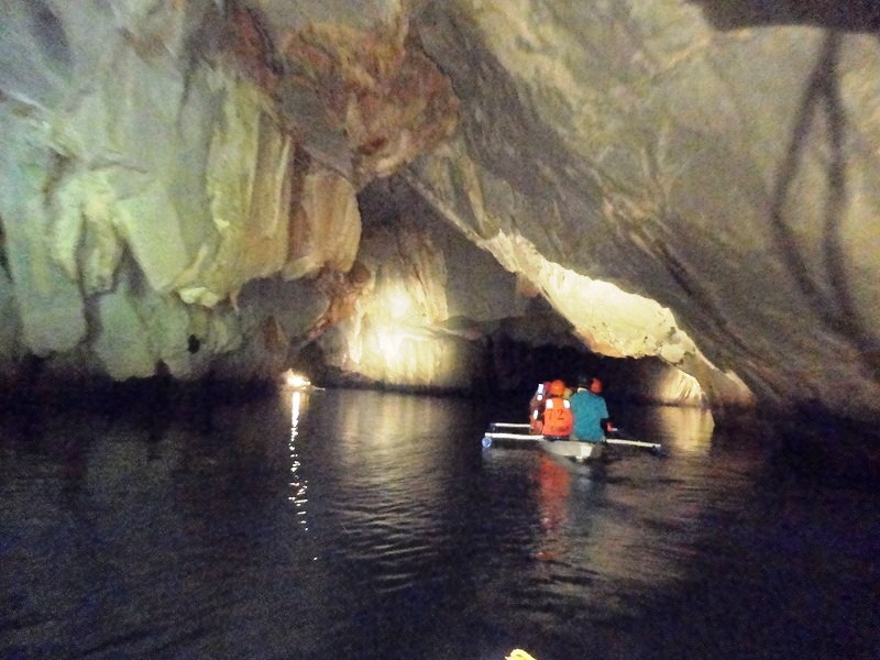
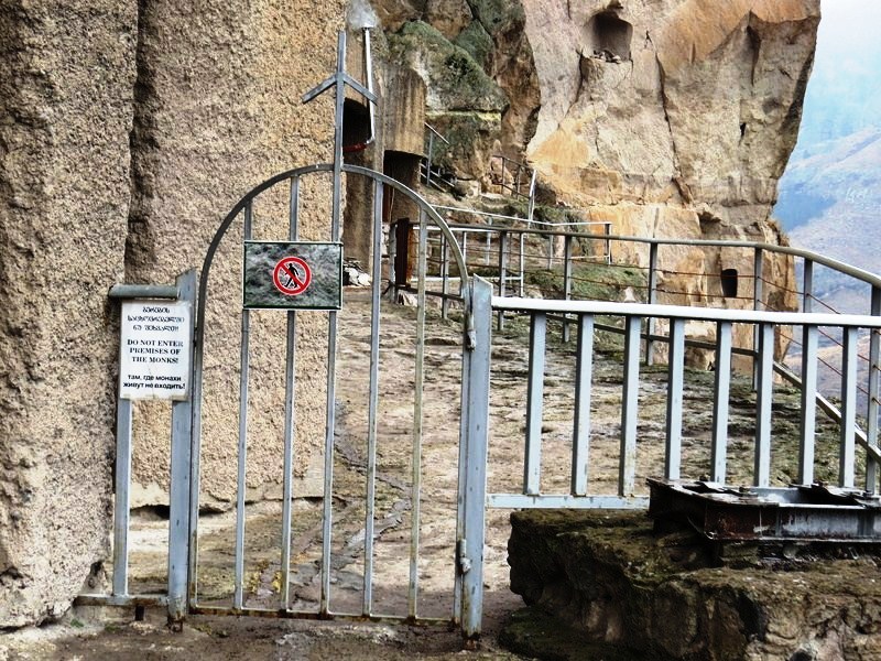
It also requires squeezing your body to fit inside the narrow and small cave openings.  It can only be explored during summer as, during the rainy season, they’re flooded and muddy. Levels 6-7 are closed. Our tour took about 30 mins.

Calinawan Cave (5)

Our guide Jason told us that one path leads to as far as the town of Montalban (others say that there are those that lead to the neighboring towns of Baras and Pililia).

Calinawan Cave (29)

The local TV fantasy series “Encantadia” was filmed here and, more recently, the Coco Martin TV series “Ang Probinsyano.” The TV series “Imortal” disturbed level 1 with silver and gray paint and glued glitters on the cave walls and other indelible and irreversible damage.

Calinawan Cave (14)

In case you get hungry or thirsty after the cave exploration, small sari-sari stores in the area sell sandwiches, soft drinks, halo-halo, mais con yelo, and biscuits.

Calinawan Cave (31)

As a spelunking experience, this is a relatively easy cave to explore, requiring no technical or special skills, especially for the first 2 levels. Well suited for first timers with no previous spelunking experience.  Levels 3-5, taking about half a day to explore, are just satisfying enough for the veterans.

Calinawan Cave (36)

Calinawan Cave: Calinawan Road, Brgy. Tandang Kutyo, Tanay, Rizal. Admission: PhP20. Tour guide fee: PhP 200 (good for 10 pax). You are provided with safety helmets and LED flashlights (however, these are very weak and you won’t be able to take great photos inside) as the second level of the cave has zero visibility. For that mandatory picture taking, use a camera with low light function. If you wish to explore layers 3-5, the guide may ask you for a consideration fee.

How to Get There: Calinawan Cave can be reached by tricycle (PhP200) from Tanay Market. For those with cars, there’s a parking area in front of the cave entrance.

Tanay Tourism Office: G/F, New Tanay Municipal Hall, M. H. del Pilar St., Tanay, Rizal 1980.  Tel: (02) 7361059 and (02) 6551773 loc 212-213.  Mobile number: (0998) 988-1590. E-mail: tanaytourism11@gmail.com. Website: www.tanay.gov.ph.

Seegrotte (Hinterbrühl, Austria)

Seegrotte

Seegrotte

We were now on our final day of our Europe Tour and, prior to our evening departure from Vienna for Manila, Grace’s cousins Popong and Freddie organized one final morning tour, this time to Seegrotte, one of the most spectacular natural monuments in the world today.  After breakfast at the hotel, we again met up with Popong and Freddie at the hotel lobby and again boarded the same hired van we used for touring yesterday.

DSC07100

Seegrotte, in southern Lower Austria, near Hinterbrühl, is a 26 km. (40-min.) drive, via the A23, from Vienna.  It is an underground cave system with a large grotto located under a former gypsum mine. From 1848 to 1912, red and grey gypsum, used by farmers as fertilizer, was mined in the mountain inside the Wagner Kogels by G. Plankenbichler. However, in 1912, an underground blasting operation in the mine went awry, opening a water pocket and causing 20 million liters of water to gush forth from behind the rock and flood the lower level galleries and adits of the mine, creating the largest subterranean (60 m. below ground) lake in Europe but causing the mine’s closure.

Listening to our guide

Listening to our guide

As a consequence, the mine remained closed for years until the 1930s when an international team of cave explorers rediscovered the unique natural spectacle and, with great enthusiasm, they opened this curiosity to the general public as a show mine in 1932.

Miners represented at work at the pause chamber of miners

Miners represented at work at the pause chamber of miners

However, during World War II, Seegrotte was requisitioned by the German military due to the fact that the subterranean site offered the best protection against bombing raids in Nazi Germany‘s “second Ruhr.” It was permanently pumped dry and inside the far flung tunnels, Heinkel Werke built an underground aircraft factory and employed over 2,000 World War II prisoners-of-war and concentration camp prisoners (1,800 forced laborers and 300 skilled workers) to produce the air frames (a total of 198 were produced) of the Heinkel He 162 Salamander, one of the first jet fighters of the world and a secret weapon of the German Luftwaffe. At the end of the war, the German armed forces destroyed the pumps that prevented the mine from filling with water.

The Three Musketeers

The Three Musketeers

After the war, a major clean-up was undertaken and Seegrotte was reopened, in the spring of 1949, as a tourist attraction of the first order. Since its reopening more than 10 million visitors from around the world have visited this former mine, 250 000 of them just last year alone. The complex also served as a location for some of the scenes from the 1993 Disney movie “The Three Musketeers,” and some of the set dressing is still in place (prison walls, and a boat in the underground lake).

The author beside the spooky gilded boat of the Three Musketeers

The author beside the spooky gilded boat of the Three Musketeers

Prison set for The Three Musketeers

Prison set for The Three Musketeers

Upon arrival and payment of admission at Seegrotte, we waited outside the entrance for the previous tour group to finish and return before entering. Above the gateway is a sign with the words “Gluck auf,” the old German miner’s greeting literally translated as “Luck up” or “Luck open.” We were forewarned that it is very cold inside (a constant 9° C, the temperature in summer and winter alike) and, as we didn’t bring a shawl, stole or jacket, we rented a blanket for €0.50. The 35-min. tour took us to 5 lighted caves depicting various activities within the mine as well as the underground lake.

The narrow tunneling adit

Popong making his way through the narrow tunneling adit

The narrow tunneling adit we passed through (anyone over 6′ would have to stoop), single file, was about 400 to 450 m. long and took us 15 mins. to traverse, a compelling recognition of the dismal workday environment of the miners as, in the past, 80 miners brought 2-3 wagons of gypsum daily to the surface through this adit.

Horse stable

Horse stable

Down the hole, we first stopped at a pause chamber, with miners represented at work, and then the former gypsum mine’s own horse stable. The horses, which pulled the heavy wagons loaded with gypsum to the surface as well as turned the horse mill, stayed up to 20 years inside the mine without going up, going blind in the process.

The 85-step stairway leading to the Blue Lake

The 85-step stairway leading to the Blue Lake

Next stop, down an easily negotiated (there’s no wheelchair access though) 85-step stairway, is the very picturesque Blue Lake whose water surface area is about 300 sq. m.  A part of the bigger lake is located 14 m. below this small lake. It is about 1.2-3 m. deep and its water temperature is about 8° C.  The eerily lovely lake’s still, lifeless (without oxygen, there is no aquatic life at all) but very clear waters glow deep blue under artificial lights.  Nearby is the spooky gilded boat and the set for D’Artagnan‘s prison.

The Blue Lake

The Blue Lake

The lake is fed by 7 underground springs but has no natural drainage. The water depth is maintained constant at around 1.2 m. by pumping out 50-60 thousand liters of water daily every night.

Boat ride along the Blue Lake

Boat ride along the Blue Lake

Here, we were to make a short (10-min.) and nondescript, electric motor-powered boat ride. Manny, Popong, Grace, Cheska and Kyle boarded ahead of me and Freddie and we had to wait for their return before boarding. The boat ride  took us through cave openings that look so beautiful, especially when reflected on the crystal clear water.

Shrine to St. Barbara

Shrine to St. Barbara

After our boat ride, we again went up the stairs and proceeded to the Chapel of St. Barbara, built 25 m, below the surface by the miners in 1864 for their dead and injured comrades and consecrated to their patron, St. Barbara. Again, the two letters G + A stand for the miner greeting “Gluck auf” (“Good luck”). Every four years, the St. Barbara Celebration takes place at the Chapel of St. Barbara on the first Sunday in December.  On that day, a senior chaplain celebrates Mass in honor of the miners. At one time, the Cardinal of Vienna attended, accompanied by the Vienna Boys Choir.

A display of a scaled model and few original airplane parts of the Heinkel He 162

A display of a scaled model and few original airplane parts of the Heinkel He 162 Salamander

Mining equipment exhibit

Mining equipment exhibit

Final stops are a display of a scaled model and few original airplane parts of the Heinkel He 162 and a museum exhibiting mine lamps and former mining tools (miner’s lamps, etc.) which were used in the past gypsum mine. This was supposed to be the end of the tour, but we still had time to explore, on our own and up a flight of stairs, to the Festsaal, the ballroom of the Berwerkes where feasts were celebrated.

Door leading to the Festsaal

Door leading to the Festsaal

The Festsaal

The Festsaal

If you have half a day to spare, Seegrotte is an interesting place to visit if you are around Vienna. It is not typical cave, so if you are looking for rock formation or typical dripstones such as stalactites and stalagmites, you will be disappointed. It is simply a huge underground space with an interesting history and an underground lake as its main attraction.

L-R- Freddie, Manny, Jandy, Kyle, Cheska, Grace and the author at the Festsaal

L-R: Freddie, Manny, Jandy, Kyle, Cheska, Grace and the author.  In the background is the fireplace of the Festsaal

During our visit, it was the perfect getaway from the heat of the Viennese summer. The tour is not recommended for people who have difficulty walking or are claustrophobic. Wear sensible footwear as the mine floor can be slippery. Beside the entrance is the nice Romerquelle cafe offering cakes, doughnuts and apple strudel. The toilets/WC are PAY only and situated about 50 m. from the attraction.

Romerquelle Cafe

Romerquelle Cafe

Seegrotte: Grutschgasse 2a, 2371 Hinterbrühl, Austria.  Tel: +43 2236 26364. Website: www.seegrotte.at.  E-mail: office@seegrotte.at. Admission: adults (€10), children (from 4 to 14 years, €7), Family Card (2 adults + 2 children, €27).

How to Get There: Seegrotte is a train and a bus journey away from Vienna. Take the S-Bahn S2 train (running every 15-20 mins.) from Meilding to Modling then, from outside the station, take Bus no. 364 or 365 (25-min. drive) and get down at Seegrotte stop. From there, it is 2-3 walk. The return bus stop is 200 m. towards Modling station.

Hoyop-Hoyopan Caves (Camalig, Albay)

Hoyop-Hoyopan Cave (photo Rommel Natanauan)

Hoyop-Hoyopan Cave (photo Rommel Natanauan)

After our short stopover at the Cathedral of St. John the Baptist in Tabaco City proper, we proceeded on our way, via a 28.3-km./28-min. drive along the Ligao –Tabaco Rd., to Camalig and a further 8 kms. (a 20-min.) drive south to Hoyop-Hoyopan Caves where we were to do some amateur spelunking. The cave is privately owned and maintained by the Soriano, Nieva and Nuylan families.  Here, we were met by Mr. Garner N. Abril, our local cave guide who was well versed in the cave’s history and its trail.

One of the cave entrances

One of the cave entrances

This natural, 3-level, tunnel-like limestone cave, one of the most popular and easily accessible caves in Albay, covers an approximate area of 31.4 sq. m. of land. Located 16 kms. from the Cagsawa Ruins, the cave’s name is derived from the Bicol word meaning “eternal whispering breeze” or “blow-blow” because of the sound of wind whistling through the main entrance.  Upon entering, we instantly felt a blow of cold air.

Mr. Garner N. Abril, our local cave guide

Mr. Garner N. Abril, our local cave guide

Our tour, done in a group, went through the subterranean path and eventually ended at the other part of the mountain.  We traversed a staircase that provided easy access to the other levels of the cave.   Strategically placed light bulb along pathways allowed us to fully appreciate the rock formations inside the cave.

Cave stalactites

Cave stalactites

In 1972, 2,000-year old bones in burial jars, beadwork and potsherds, dating from 200 B.C. to 900 A.D. and attributed to Calanay complex, were excavated here.  The artifacts are now housed at the National Museum in Manila, while some are displayed at nearby Camalig Church. The late Franciscan Fr. Cantius Kobak, OFM, an archaeologist, classified the cave as old as 3000 B.C to 4000 B.C.

Media team posing beside a cave pool

Media team posing beside a cave pool

During the Japanese occupation in World War II, Hoyop-Hoyopan Cave served as a guerilla and refugee camp of the Hukbo ng Bayan Laban sa Hapon (Hukbalahap) and as a hospital and orphanage. According to stories from the townsfolk, it took three years before the enemies discovered the camp.  During the Martial law era, when curfew was strictly imposed, this cave served as a safe haven for party goers and, when a destructive typhoon strikes in the area, as a refuge and shelter.

The Dance Hall

The Dance Hall

The cave has wonderful formations of stalagmites and stalactites and numerous entrances and exits varying from two to 10 m. in diameter. Many of the different stalactite formations resemble a chicken drumstick,a statue of the Blessed Virgin, a hanging snake, a hand formation, a sexy lady with long hair, a hanging man, a statue of Moses and a crocodile tail.  In order to reach the different chambers, these narrow passageways tested our skill in squeezing, scrambling, crawling, and kneeling to get through to a mini-pond (some sections of the cave have puddles of water) and the “dance hall” (a wide open-space with a round concrete platform installed in the middle ).   One of the cave’s openings is a grand window, through which travelers can enjoy a splendid view of Mayon Volcano.

Mano po

Mano po

After we exited the cave, we bought some crystals, mounted on key chains, pendants or necklaces, and some native products (hats, etc.) available for sale at a stall.  I bought a crystal  necklace and key chain as well as one in its raw form (prices, depending on the size of the crystal stone, ranges from PhP50- 500).

Jollibee Chicken Joy Drumstick

Jollibee Chicken Joy drumstick?

Hoyop-Hoyopan Cave: Brgy. Cotmon, Camalig, Albay. Admission: PhP200 for two to three persons, while the parking fee is P25 is also charged. A local tour guide, , can be hired for PhP100 to PhP200 (inclusive of 1 lamp). An additional PhP300 is charged if you want to turn on the lights inside the cave. Public transportation to the cave is also available.

Mayor’s Office: Municipal Hall, Poblacion, Camalig, 4502, Albay. Tel.: (052) 484-1965

Municipal Tourism, Culture and Arts Office: Camalig Tourism  and Pasalubong Center, Brgy. 2, Camalig, Albay.  Mobile number: (0927) 621-3315.  E-mail: camalig_tourism@yahoo.com.

Provincial Tourism and Cultural Affairs Office (PTCAO): Albay Tourism Bldg., Albay Astrodome Complex, Capt. F. Aquende Drive, 4500 Legaspi City, Albay.  Tel: (052) 481-0250 and (052) 742-0242. E-mail: albaytourism@yahoo.com and albaytourism@gmail.com.

Puerto Princesa Underground River (Palawan)

Sheridan Beach Resort & Spa Media Tour

Upon checking in and having lunch at the Sheridan Beach Resort & Spa, Lester, Charmie, Joy and I walked along Sabang Beach towards the wharf for the first of our resort-sponsored activities – a visit to the world-renowned Puerto Princesa Underground River (PPUR).

Puerto Princesa Underground River

Puerto Princesa Underground River

This beautiful 5,753-hectare national park and terrestrial reserve, considered as one of the most important biodiversity conservation areas in the country, is also is one of the few places where a full mountain to sea ecosystem still exists.  Around the park are the ancestral land domains of at least two indigenous cultural communities (Tagbanuas and Bataks).

Sabang Port

Sabang Port

A major tourist destination in the country, this national park is ideal is a spelunker’s paradise. This underground section of the Cabayugan River, at 8.2 kms. (5.1 mi.), is reputedly the world’s longest navigable underground river.  It is also ideal for trekking, swimming, birdwatching and hiking deep in the forest.

Visitors waiting for their ride at Sabang Port

Visitors waiting for their ride at Sabang Port

The area was declared as a national park on March 26, 1971 by virtue of Presidential Proclamation No. 835 to protect the unique environmental and cultural features of the area.  In the late 1980s, the late Jacques Cousteau penetrated up to 3 kms. into the cave system.  In 1983-86, its area was increased from 3,901 hectares to its present 5,753 hectares (includes an adjacent area of good forest around Cleopatra’s Needle).

Magnificent limestone cliffs

Magnificent limestone cliffs

In 1986, its jurisdiction was returned to the DENR Southern Luzon Regional Office.  In 1991, its area was expanded to 22,202 hectares.  That same year, it won the Pacific Asia Travel Association (PATA) Gold Award for Environment.  In 1994, management of the park was turned over to the Puerto Princesa city government.  It is also partially supported by the World Wide Fund for Nature.

Puerto Princesa Underground River

The author at Puerto Princesa Underground River

This national park was declared a natural World Heritage Site by UNESCO on December 4, 1999 due to its outstanding universal value and, on January 28, 2012, was voted by the global community as one of the New Seven Wonders of the World, for being the longest navigable subterranean river.

Registration Area

Registration Area

The park, managed by the Puerto Princesa City government through a Protected Area Management Board, is the first such national park devolved and successfully managed by a local government unit.  Its mission is to “protect the underground river in its natural state.”

Lester, Joy, Charmie and the author at the beach

Lester, Joy, Charmie and the author at the beach

Lying on the foot of the 1,028-m. high Mt. St. Paul (Sabang’s highest point), the park is located in Sitio. Sabang, Brgy. Cabayugan, 81 kms. west of Puerto Princesa City and is bounded on the north by St. Paul’s Bay and on the south by the Babuyan River.  The dome-shaped Mt. St. Paul was named as such after London’s St. Paul Cathedral in 1850 by British sailors of the HMS Royalist.

The short hike from the beach to the lagoon

The short hike from the beach to the lagoon

The park’s topography ranges from flat terrain to rolling hinterlands, from hills to rocky mountains  of marble and limestone, and from rocky shores to white sand beaches. It is also composed of lush tropical old growth forest, thinly vegetated karst limestone cliffs (one-third of the park’s area) and thick jungle cover.   The park also has 290 hectares of marine area encompassing shoreline and offshore corals reefs.

The turquiose lagoon

The turquiose lagoon

The park protects a dense, primary or old growth tropical rainforest which covers two-thirds of the park. Its forest, representing 8 types of forest formations, consists of at least 285 tree species and is dominated by dipterocarps. Vegetation types include lowland forest (often with a 35-m. canopy), coastal and karst forest.  Aside from these, there are also 800 identified plant species.  The underground river supports plant species such as Dracontemelon dao, Pometia primata and Diospyrus sp.

All geared up and ready to go ....

All geared up and ready to go ….

The forest is home to at least 30 species of mammals, 265 bird species, 19 species of reptiles including 2-m. long monitor lizards or bayawak (Varanus salvator) plus 10 species of amphibians. The underground river is inhabited by countless cave-roosting bats plus the endemic and threatened Palawan flying fox (Acerodon leucotis) and the restricted-range Palawan swiftlet (Collocalia palawensis).

Entering Pining Cave

Entering Pining Cave

Ever since being identified as one of the New 7 Wonders of Nature, the PPUR management has organized booking to ensure that there would be no overcrowding. Transport from mainland to the entrance to the PPUR is well-organized and they now have environmental charges for the upkeep of the place.

Puerto Princesa Underground River (37)

Into the dark recesses of the cave ……

A “No Permit, no entry” policy is also strictly implemented in the park and, before our going to the park, permits were formally secured from the St. Paul Subterranean River and National Park Office. Once at the port of Sabang, we all waited some time for our turn to board our assigned motorized outrigger boats.

Puerto Princesa Underground River (51)

The 20-min. boat ride from the port to a beach on the northwest coast of the city, on the far side of the bay, was uneventful and smooth all the way. During the trip, we passed many beautiful limestone cliffs along the way.

Puerto Princesa Underground River (83)

Upon arrival at the beach, we all registered our names at the PPUR office and then made a short hike, under huge shady indigenous trees, to the edge of a picturesque clear, turquoise blue lagoon framed by ancient trees growing right to the water’s edge.  On the other side of the lagoon was Pining Cave, the entrance to the underground river.  We again waited our turn to board small 8-seater outriggers boats that would transport us into the cave.

Puerto Princesa Underground River (79)

Soon our turn arrived and we were assigned an English-speaking guide plus an oarsman. Life vests and helmets were provided. Lester and I were seated at the prow of the boat and I was assigned a spotlight on our bow to somehow light up an incredible world carved out of rock.

Puerto Princesa Underground River (62)

Throughout the tour, I was directed by the guide on where to point it. With only this spotlight as light source, my digital camera had a hard time focusing in the dark cave. We were paddled slowly into the deeply fissured, yawning opening of the huge cave below the vertical limestone cliff.  As we entered, vertical slabs of limestone hung over us like giant teeth and edible-nest swiftlets would swoop in over our heads.

Puerto Princesa Underground River (74)

A strip of bacon …… ?

The river is navigable up to about 4.3 kms. (a little over half its length) , with brackish waters underneath going as deep as 30 ft., but a typical 45-min. river cruise covers only 1.5 kms. of the navigable stretch.  We were to pass through a series of caves with cathedral chambers, wide hallways studded with stalactites, stalagmites and other interesting geologic formations.

Puerto Princesa Underground River (49)

As we paddled deeper into the darkness, we reached, at the 0.6-km. mark, the high, vaulted 60 ft. high “Cathedral,” the underground river’s first main attraction.  Everywhere I swung the spotlight, there were bats hanging like fruit from the cave roof.  Their droppings around the walls of the cave gave out a distinct odor.

Puerto Princesa Underground River (52)

Here, our very knowledgeable park guide showed us spectacular limestone formations with a kind of orange toffee color.  The stalactites and stalagmites inside are associated with so many things and a number were aptly named the “Holy Family” (a group of figures like a Nativity scene), the “Angel,” the “Virgin Mary” and the “Candle” (a giant bulbous stalagmite like a melting candle).  The guide would occasionally inject his lecture describing the elements of this natural wonder with some really funny anecdotes and jokes, their creative flair making the experience even more entertaining.

Stalactite

Further on, we passed the “fruit and vegetable” section, with stalagmites on the walls that look like giant mushrooms, garlic, an upside-down corn, a clump of cacao beans, carrots and pumpkins, all as big as the average human being. Our guide also pointed to us what was supposed to be strip of bacon, half the face of Jesus Christ and a woman with shapely legs that he aptly called Sharon Stone.

Puerto Princesa Underground River (92)

Further ahead, at the 1-km. mark, is a marvelous, 400-m. long and straight gallery called “God’s Highway.”  Upon reaching a breathtakingly high dome with a 65 m. (213 ft.) vertical clearance (the cave’s highest point) above river level, our boat turned around.  Not covered by our route was the “Glittering Stone,” at the 3.8-km. mark, and the “Rockpile,” at the 4.3-km. mark.

Puerto Princesa Underground River (55)

The grandeur of the unique formations, small and large chambers, stalactites and stalagmites of the underground river that we saw during our interesting and very enjoyable river boat ride, all uniquely designed by nature, makes it truly deserving as one of the New 7 Wonders of Nature.  A truly awesome natural spectacle.

Puerto Princesa Underground River (111)

Exiting the cave

Puerto Princesa Underground River (PPUR) Office: Badjao Inn, 350 Rizal Ave., Brgy. Bancao-Bancao, Puerto Princesa City 5300, Palawan. Tel: +63(48)723-0904 (Sabang). Fax: +63(48)434-2509. E-mail: info@puerto-undergroundriver.com and undergroundriver_ppsrnp@yahoo.com. Website: www.puerto-undergroundriver.com.

Puerto Princesa Underground River (PPUR) Booking Office: City Coliseum, Peneyra Rd., Puerto Princesa City 5300, Palawan. Open Mondays to Fridays, 8AM to 4PM with no lunch break, and Saturdays and Sundays, 8AM-12 noon and 1-5PM.

Steps in applying for a permit:

  1. Get a transaction number and wait for your turn.  Make sure to bring a valid ID with you when you purchase your permit.
  2. Fill out the form and submit personal details for processing. If you book through an agent, they will require the full name and age of everyone in your group.
  3. If you’re a walk-in visitor, proceed to Counters 1 and 2. Tour operators and travel agencies line up on Counters 3 and 4
  4. Let the staff compute the payment.
  5. Obtain the signature of a PAMB representative to finalize your permit.

General Entrance Fees to the Puerto Princesa Subterranean River National Park

  1. Adult (Filipino) – P100
  2. Minor (Filipino) – P75
  3. Adult (foreigner) – PhP150
  4. Minor (foreigner) – PhP100
  5. Senior Citizen – PhP100
  6. Differently Abled – PhP100

Cave Entrance fees -includes payment for the paddle boat and use of protective gear (helmets, life vests):

  1. Adult (Filipino) – PhP175
  2. Minor (Filipino) – PhP100
  3. Adult (foreigner) – PhP250
  4. Minor (foreigner) – PhP150
  5. Toddlers and children 3 to 12 years old – PhP75. Children below 2 years old are not permitted for safety reasons.

Sheridan Beach Resort & Spa: Sabang Beach, Sitio Sabang, Brgy. Cabayugan. Puerto Princesa City, Palawan. Palawan Sales Office: Jeco Bldg., Rizal Ave. Extn., Puerto Princesa City.  Tel (+63 48) 434 1448 to 49 and 723 7278. Mobile Numbers (+63 917) 308-3245 and (+ 63 917) 308-3245. Cebu Sales Office: Sheridan Bldg., Ouano Ave., NRA, Mandaue City.  Tel: (+63 32) 236-1001. Fax: (+63 32) 345-1000. Mobile number: (+63 917) 306-6984. Manila Sales Office: tel: (+63 2) 939-8888. Mobile number: (+63 917) 726-5224. E-mail: reservations@sheridanbeachresort.com.  Website:www.sheridanbeachresort.com.
Instagram: @sheridanresorts
Instagram official tag: #SheridanPalawan
Twitter: @sheridanresorts
Facebook: facebook.com/sheridanbeachresortandspa

Uplistsikhe Cave Complex (Georgia)

We were already through with the first day of our 3-day GNTA-sponsored tour of the Georgia countryside, our last destination being the Stalin State Museum in Gori.  We still had a lot of daylight left, so we decided to continue on to the ancient, rock-hewn and now abandoned town of Uplistsikhe (literally meaning “the lord’s fortress”), located in Shida Kartli, a suburb just 14 kms. (a 20-min. drive) east of Gori.

Uplistsikhe Cave Complex

Uplistsikhe Cave Complex

Uplistsikhe is remarkable for the unique combination of various styles from rock-cut cultures of the region, most notably from Cappadocia in Anatolia (now modern Turkey) and Northern Iran, and the co-existence of pagan and Christian architecture. Built on the high rocky sandstone massif along the left bank of the Mtkvari River, the area was identified by archaeologists as one of the oldest urban settlements in Georgia, containing various structures dating from its founding in the Late Bronze Age (around 1,000 BC) to the Late Middle Ages (13th century AD). Its natural sandstone rock easily lent itself to various kinds of treatment, making it possible to create complex decorative compositions.

The Mtkvari River

The Mtkvari River

Strategically located in the heartland of ancient kingdom of Kartli (or Iberia as it was known to the Classical authors), the town’s age and importance as a major political and religious center of the country (between the 6th century BC and the 11th century AD) led medieval Georgian written tradition to ascribe its foundation to the mythical Uplos, son of Mtskhetos, and grandson of Kartlos.

The tourist complex

The tourist complex

Early in the 4th century, with the Christianization of Kartli, Uplistsikhe seems to have declined in its importance, losing its position to Mtskheta and, later, to Tbilisi, new centers of Christian culture. During the Muslim conquest of Tbilisi in the 8th and 9th century, Uplistsikhe reemerged as a principal Georgian stronghold, becoming the residence of the kings of Kartli, during which the town grew to a size of around 20,000 people and evolved into an important caravan trading post along the Silk Road.  However, a Mongol raid in 1240 destroyed large parts of the town, marking the ultimate eclipse of the town.  It was virtually abandoned and, only occasionally, in times of foreign intrusions, used as a temporary shelter.

The start of our hike

The start of our hike

The approximately 4-hectare Uplistsikhe complex, tentatively divided into 3 parts, consists of a south (lower), middle (the largest) and north (upper) part. The middle part, containing the bulk of Uplistsikhe’s rock-cut structures, is connected to the southern part via a narrow rock-cut pass and a tunnel. Narrow alleys and, sometimes, staircases radiate from the central “street” to the different structures.

The Theateron (Theater)

The Theateron (Theater)

The ornate ceiling carved with octagonal Roman-style designs

The ornate ceiling carved with octagonal Roman-style designs

Most of the caves are devoid of any decorations. However, some of the larger structures have coffered, tunnel-vaulted ceilings, with stone carved in imitation of logs, as well as niches, which may have been used for ceremonial purposes, in the back or sides. Archaeological excavations in the area since 1957 (when only the tops of a few caves were visible) have uncovered numerous artifacts from different periods, many of which are in the safekeeping of the National Museum in Tbilisi.  Most of the unearthed artifacts include gold, silver and bronze jewelry, plus samples of ceramics and sculptures.

Sopho and Pancho performing "Romeo and Juliet" at the Theateron

Sopho and Pancho performing “Romeo and Juliet” at the Theateron

The earthquake in 1920 completely destroyed several parts of the most vulnerable areas and the stability of the monument remains under substantial threat, prompting the Fund of Cultural Heritage of Georgia, a joint project of the World Bank and Government of Georgia, to launch a limited program of conservation in 2000. Since 2007, the Uplistsikhe cave complex has been on the tentative list for inclusion into the UNESCO World Heritage program. Originally, the city had about 700 caves but, today, only 150 remain.

Round pits thought to have been used for corn storage or for sacrificial purposes

Round pits thought to have been used for corn storage or for sacrificial purposes

We all arrived at Uplistsikhe at around 4 PM, paid the entrance fee and started our 2-hour exploration of the 40,000 sq. m. Shida Qalaqi (“Inner City”), which is less than half of the original whole, by hiking about 5 m. up the rocks (opposite the toilets and cafe at the entrance), then following the rock-cut path to the left. Steps, with metal railings, lead us up through what was the main gateTo the right, sitting under a corrugated roof, is the excavated main tower of the Shida Qalaqi’s defensive walls.

Tadpole-shaped pits that may have been ovens for baking bread

Tadpole-shaped pits that may have been ovens for baking bread

We observed many round pits dug in rock, thought to have been used for corn storage or for sacrificial purposes, while tadpole-shaped pits may have been ovens used for baking bread.  Scattered throughout the city are narrow circular holes, of different depths, cut in the ground to hold several prisoners.

Inspecting a wine cellar

Inspecting a wine cellar

We also noticed a wine cellar, a pool for water storage and a wine press where grapes are crushed, allowing the juice to run down a chute into another container.  During the hike, we made short stops in between to admire the beautiful view of the river and the whole surroundings.

A wine press

A wine press

Ahead of us, overlooking the Mtkvari River, is the Theateron (Theater), probably a temple from the 1st or 2nd century AD where religious mystery plays may have been performed.  This cave has a pointed arch, carved in the rock above it, and an ornate, tunnel-vaulted ceiling carved with octagonal Roman-style designs resembling three-dimensional plaster work.  Behind the stage are dressing rooms.

The Temple of Makvliani

The Temple of Makvliani

Returning towards the main gate, we turned left to wind your way up the main street. Down to the right is the large pre-Christian Temple of MakvlianiWith an inner recess behind an arched portico, the open hall in front has stone seats for priests.

Tamaris Darbazi (Hall of Queen Tamar)

Tamaris Darbazi (Hall of Queen Tamar)

A little further up, on the left, is the big hall known as Tamaris Darbazi (Hall of Queen Tamar), almost certainly a pagan temple (though Georgia’s great Christian Queen Tamar may have used it later).  Behind two columns cut from the rock is a stone seat dating from antiquity. The hall has loggias on three sides.  The ribbed stone ceiling, cut to look like wooden beams, has a hole to let smoke out and light in. An open area, to its left, has stone niches along one side, thought to have once been a pharmacy or dovecote. To the right of Tamaris Darbazi is a large cave building, probably a pagan sun temple used for animal sacrifices and, later, converted into a 3-naved Christian basilica.

The 3-naved Christian basilica

The 3-naved Christian basilica

Near the summit of the hill is the Uplistsulis Eklesia (Prince’s Church), a picturesque triple-church Christian basilica built with stone and brick in the 9th -10th centuries over what was probably Upliistsikhe’s most important pagan temple. Inside the simple interior are some candlelit icons but no frescoes (they have been whitewashed).

Uplistsulis Eklesia (Prince’s Church)

Uplistsulis Eklesia (Prince’s Church)

Outside, we again had breathtaking views of the river and the Caucasus Mountains. On our way back, we entered a dark, 40 m. long tunnel with a long flight of metal stairs, behind a reconstructed wall beside the old main gate, running down to the Mtkvari River, an emergency escape route that could also have been used for carrying water up to the city.

The simple church interior

The simple church interior

Our visit to this lovely place with an interesting history was unique in that we really had full access to the whole site (elsewhere most of this would all be fenced off) so we really got the feel of this city literally cut into the mountainside by soaking up its history and rustic charm. Well off the beaten track, but definitely worth a visit. The memory of this lovely ancient cave city would linger in my mind long after I have gone home.

Exiting down the 40 m. long tunnel

Exiting down the 40 m. long tunnel

Uplistsikhe: Shida Kartli, Gori, Georgia.  Open 11 AM – 6 PM. Admission: 3 GEL.

Qatar Airways has daily flights from Diosdado Macapagal International Airport (Clark, Pampanga) to Tbilisi (Republic of Georgia) with stopovers at Hamad International Airport (Doha, Qatar, 15 hrs.) and Heydar Aliyev International Airport (Baku, Azerbaijan, 1 hr.). Website: www.qatarairways.com.

The Cave City of Vardzia (Georgia)

From Akhaltsikhe, it was a fantastic drive up to Vardzia, with old castles and churches along the way. Soon, we espied the wide-mouthed caves gaping at us from across the valley as we drove in. Vardzia, on the left bank of the Mtkvari River, 30 kms. from the town of Aspindza, was excavated from solid rock along the slopes of the Erusheti Mountain during the second half of the 12th century. The caves, stretching along the cliff for some 500 m., rises up to 19 tiers.

The Cave City of Vardzia

The Cave City of Vardzia

Four distinct building phases have been identified at Vardzia. The first phase, during the reign of Giorgi III (1156-1184), was when the site was laid out and the first cave dwellings excavated; the second between Giorgi’s death and the marriage of fabled queen Tamar, his successor, in 1186 (when the Church of the Dormition was carved out and decorated); the third from that date until Tamar’s victory at the Battle of Basian (circa 1203), during which time many more dwellings as well as the defenses, water supply, and a complex irrigation network ( to water fertile, terraced farmlands on the outside slopes) were constructed.

The author and Riva

The author and Riva

The fourth phase was a period of partial rebuilding, after the devastating earthquake of 1283 literally ripped the place apart, shattering the mountain slope, destroying more than two-thirds of the city and exposing the hidden innards of the remainder. Vardzia escaped the onslaught of the Mongol invaders in the 1290s and the monastery community persisted until it was sacked by the Persians, under Shah Tahmasp I, in 1551.  After the Ottoman takeover in the 16th century, the site was largely abandoned.

The steep uphill path to the cave city

The steep uphill path to the cave city

The greater Vardzia area includes also the early 11th-century church at Zeda Vardzia and the 10th to 12th-century rock village and cave churches of Ananuri. The main lower site, carved from the cliff’s central stratum of tufaceous breccia at an elevation of 1,300 m. above sea level, is divided, into an eastern and a western part, by the Church of the Dormition. In the eastern part of the complex are 79 separate cave dwellings, in 8 tiers, with a total of 242 rooms, including 6 chapels, “Tamar’s Room,” a meeting room, reception chamber, pharmacy and 25 wine cellars (185 wine jars sunk into the floor document the importance of viticulture to the monastic economy).

Steel ladders facilitate access to caves

Steel ladders facilitate access to caves

In the western part, between the external bell tower and the large main church, are a further 40 houses, in 13 tiers, with a total of 165 rooms, including 6 chapels, a refectory with a bakery, other ovens for baking bread, and a forge. Beyond the bell tower, the complex rises to 19 tiers, with steps leading to a cemetery. Infrastructure includes access tunnels, water facilities and provision for defense. It is assumed that the only access to this mountain stronghold was via a hidden tunnel whose entrance was near the banks of the Mtkvari River.

Walkways connecting the caves

Walkways connecting the caves

The Church of the Dormition, the central spiritual and monumental focus of the site, is sometimes known as the Church of the Assumption, which corresponds with the Orthodox Feast of the Dormition.  It dates to the 1180s and was erected by Tamar  to house the icon of the Virgin of Vardzia after receiving divine help in her campaigns. It has an important series of wall paintings. Similarly carved from the rock, with walls reinforced in stone, the church is 8.2 m. (27 ft.), 14.5 m. (48 ft.) long and has a height of 9.2 m. (30 ft.).

The Church of the Dormition

The Church of the Dormition

The wall paintings of the church and narthex, not frescoes but executed in secco, are of crucial significance in the development of the Medieval Georgian mural painting.  Ascribed to Rati Surameli, eristavi of Kartli, portraits of him, as well as royal founders Giorgi III alongside her niece  Tamar, are commemorated on the north wall. Tamar lacks the ribbon that is the attribute of a married woman.  Her inscription includes the formula “God grant her a long life.” Giorgi, on the other hand, does not.  The paintings are dated to between Giorgi’s death in 1184 and Tamar’s marriage in 1186.

Frescoes (1)

Frescoes (3)

At the vaults and upper walls are episodes, in a sequence, from the life of Christ (Annunciation, followed by the Nativity, Presentation in the TempleBaptismTransfigurationRaising of LazarusTriumphal Entry into JerusalemLast SupperWashing of the FeetCrucifixionHarrowing of Hell,AscensionDescent of the Holy Spirit and Dormition).

Frescoes (5)

Frescoes (7)

At a lower level, more accessible as intercessors, are paintings of saints and stylites. On the sanctuary’s rear wall, behind the altar, are Twelve Church Fathers while  in the narthex are scenes of the Last JudgmentBosom of Abraham, Angels bearing a Medallion with the Cross, and 3 scenes from the life of Saint Stephen.  Other paintings were lost during the 1283 earthquake.

Frescoes (9)

Since 1985 the site has formed part of the Vardzia Historical–Architectural Museum-Reserve, which includes 46 architectural sites, 12 archaeological sites, and 21 sites of monumental art.  In 1999, the extended area of Vardzia-Khertvisi, now part of a state heritage reserve, has been submitted for future inscription on the UNESCO World Heritage List as a Cultural Site.  In 2007, it was resubmitted as a mixed Cultural and Natural Site.

Tadpole-shaped pits that may have been ovens for baking bread

Tadpole-shaped pits that may have been ovens for baking bread

The Refectory

The Refectory

From 2012, conservation of the wall paintings in the Church of the Dormition was carried out by the Courtauld Institute of Art in conjunction with the National Agency for Cultural Heritage Preservation of Georgia and Tbilisi State Academy of Arts. Today, the place is maintained by a small group of zealous monks.  About 300 (out of 6,000) apartments and halls can be visited and, in some tunnels, the old irrigation pipes still bring drinkable water.

The premises of the monks

The premises of the monks

Upon arrival, Ruby opted to stay behind at the parking lot (she has been to Vardzia before) while Riva and I walked up a path whose initial approach leads steeply uphill for 30-40 m. up.  It was not easy climbing, but we wore good shoes and I brought along my trekking pole (actually a monopod).  As we went through the caves at Vardzia, we walked up and down very steep, narrow and low corridors and stairs, most deformed with time.   Some of the balconies we passed by were also not fenced (truly not for the faint of heart).  We sometimes went through tunnels in near total darkness.

A narrow passageway

A narrow passageway

Though the earthquake destroyed a significant part of this cave city carved into the mountainside, what remains was still an unbelievable sight and quite unique and truly amazing to behold.  Vardzia looks like it was taken directly from the pages of Lord of the Rings. All I can really say was “Wow.” Walking around and seeing the caves, and the connections between them, was truly mind blowing. The views of the valley are interesting and unbelievable, and the combination of architectural buildings and the caves is astonishing. The most surprising part of our visit was the lack of other visitors. For about 2 hours, Riva and I explored the caves and paths on the mountain but we encountered less than 20 people!

View of the valley from the 2-arch portico of the Church of the Dormition

View of the valley from the 2-arch portico of the Church of the Dormition

Vardzia: Samtskhe-Javakheti, Georgia.  Open daily (except Mondays), 10 AM – 7 PM.  Admission: 3 GEL (adults), 1 GEL (students), 2 GEL (group of 10 person or more).

Ticket Office

Ticket Office

How To Get There: From Tblisi, take a marshrutka (minibus) from Digomi Bus station to Akhaltsikhe. Travel time is about 3 to 4 hours and fare is 12 GEL. From Akhaltsekhi, take another marshrutka to Vardzia.  Travel time is an hour and costs 6 GEL. For Vardzia, the taxi (worth it if you are a group of 3 to 4 people that can share the fare) is the easiest mode of transport while a marshrutka the second best option. The last marshrutka from Akhaltsikhe for Vardzia leaves at 1:20 pm. Be there 10 minutes earlier as, once full, the marshrutka will depart earlier. The marshrutkas operate 3 times a day. Leave Tbilisi by 7 AM so that you can reach Akhaltsikhe by 10 AM and catch the marshrutka leaving for Vardzia at 10:30 AM and return to Akhaltsikhe via the last marshrutka at 3 PM. The last marshrutka for Tbilisi from Akhaltsekhi departs at 7 PM.

Taxi hired from Akhaltsikhe

Taxi hired from Akhaltsikhe

Qatar Airways has daily flights from Diosdado Macapagal International Airport (Clark, Pampanga) to Tbilisi (Republic of Georgia) with stopovers at Hamad International Airport (Doha, Qatar, 15 hrs.) and Heydar Aliyev International Airport (Baku, Azerbaijan, 1 hr.). Website: www.qatarairways.com.

The Coral Garden and Underwater Cave of Puerto Galera (Mindoro Oriental)

A number of us availed of a package tour to San Antonio Island consisting  of a visit to an underwater cave and snorkeling the spots around the Coral Garden, the  premier snorkeling area of Puerto Galera, looking for a meter long giant clam underneath —all for PhP300. Our outrigger boat was small carrying, aside from the boatman, just me and Sheena as big boats cannot go near the shallow area of the Coral Garden.  Though I dabbed lots of sunblock on my skin, I forgot to bring a hat and my sunglasses, sorely needed as the sun was way up in the sky..

On our way to the Coral Garden

On our way to the Coral Garden

Our boat made landfall at another resort to pick up our snorkels then proceeded to the Coral Gardens.  Here, we donned our snorkels, dropped into the water and clung on to a nylon cord, between the boat and the outrigger, as the boat slowly dragged us along as we snorkeled. At some parts, the water was so shallow the corals almost touched my belly.  Tourists here are encouraged to bring bread to feed the fishes.

Snorkelling alongside the moving boat

Snorkelling alongside the moving boat

The underwater cave, our next destination, was just a 10-min. boat ride from Coral Garden.  It was located on one corner of a small coral rock formation beside a small white sand beach called Munting Buhangin.  There were a lot of boats parked along the beach and we could also see a long queue of tourists lining up to enter the cave. As such there were stalls, manned by locals, selling refreshing halo-halo (PhP25). Not waiting to see our boat parked, Sheena and I alighted from the boat and made our way to the rock formation.

The narrow white sand beach

The narrow white sand Munting Buhangin Beach

Getting up the rock formation was difficult as we had to carefully find our footing as the rocks were quite sharp and jagged. Its a good thing I brought along thick slippers.  The top of the formation has a panoramic view of the beach, the emerald green water of the sea and various rock formations nearby.The entrance of the cave had a bamboo stairs where we could climb down.

The queue up the rock formation

The queue up the rock formation

The underwater cave was not totally drenched in darkness, thanks to some rays of the sun beaming through a natural skylight.  The water inside was now deep, it being high tide when we arrived, but it wasn’t so cold.  High tide also prevented us from seeing the cave’s opening to the sea. Sheena and I alternately took each other’s picture inside the cave and through the skylight as we weren’t able to bring our boatman with us to take our pictures.

The author inside the underwater cave

The author inside the underwater cave

Back at our boat, we continued on towards the Coral Garden where we could find the giant clam. The place was almost in the middle of the bay. We again donned our snorkels and dove in. The Coral Garden obviously was littered with colorful corals plus different variety of fishes. However, even if I kept my eyes opened and peeled I still couldn’t find the giant clam.

Sheena underneath the cave's skylight

Sheena underneath the cave’s skylight

Automobile Association Philippines (AAP): 28 EDSA, Greenhills, San Juan City.  Tel: (632) 655-5889.  Fax: (632) 655-1878.  E-mail: info@aap.org.ph. Website: www.aap.org.ph.
AAP Travel: G/F, Sea Tower Bldg., 2332 Roxas Blvd. cor. Arnaiz Ave., Pasay City. Tel: (632) 551-0025.  Fax: (632) 551-0014. E-mail: info@aaptravel.com.  Website:www.aaptravel.com.ph.
Provincial Tourism Office: Provincial Capitol, Calapan City, Mindoro Oriental.  Tel: (043) 286-7046 and (043) 441-0306.

The Pagbilao Islands (Pagbilao, Quezon)

It was already midway in the afternoon when we finished our lunch at Cortijo de Palsabangon Farm Park & Restaurant and, according to Lurhen, we had to leave now if we were to catch the boat and avoid the low tide at Pagbilao Wharf (also known as Daungan) in Sitio Kalawit.  Up ahead was the piece de resistance of our Appsline Travel-sponsored Lucena-Pagbilao Media Tour – the Pagbilao Islands.

Author at Pagbilao Grande Island

Author at Pagbilao Grande Island

Upon arrival at Daungan, our huge 25-pax outrigger boat was already waiting for us.  Here, we met up with Mr. Celedonio “Dionnie” Dapla, member of the town’s tourism council and former head of the DENR Mangrove Experimental Forest.  We were supposed to visit Dionnie’s forest-farm and nursery in Brgy. Pinagbayanan but, as it was already late in the day to do so, he just saw us safely off.

L-R: The author, Lurhen, Dionnie, Rannie and Mel

L-R: The author, Lurhen, Dionnie, Rannie and Mel at Daungan

Mel, Maichel, Angela, Lurhen (with her son Marxus), Rannie and I were soon on our way, cruising the river, passing thick patches of mangrove forests along the way before heading out into Pagbilao Bay and the open sea.

Mangrove forests

Mangrove forests

The Pagbilao Islands, also called Pulo Island, are a lovely pair of islands (Pagbilao Grande in the north and Pagbilao Chico in the west)  joined together by a 500 m. long, 200 m. wide (3 m. above sea level at its highest point) sandy isthmus called Tulay Buhangin (meaning “sand bridge”).  The main settlement (also called Tulay Buhangin) is located here.

On our way into the open sea

On our way into the open sea

Though part of Pagbilao town, the islands are more accessible by boat from Padre Burgos.  Bounded by Laguimanok Bay in the north and east and Tayabas Bay in the west, the islands are 100 feet above sea level on a promontory overlooking Padre Burgos town to the east.  This ancient and still developing coral rock formation has numerous coves, caves cliffs and a hilly interior with clumps of giant yuccas and small, emerald forests.  There are also white sand beaches and rich fishing grounds.

Patayan Island (Pagbilao Chico Island)

Patayan Island (Pagbilao Chico Island)

Around 30-40 mins. on our journey we passed Pagbilao Chico Island, also called Patayan Island.  It has a smooth stone beach and a single privately-owned beachhouse that can be rented out.  Its Bansilan Cave has cathedral-like dimensions.

The Team Energy coal-fired thermal power plant

The Team Energy coal-fired thermal power plant

We next espied the tall chimney of 735-MW Team (Tokyo Electrification and Marubeni) Energy coal-fired thermal power plant.  During our visit, a  huge cargo ship was unloading coal at the power plant.  The plant is the landmark for those taking the land route to Puting Buhangin Beach. Turning a corner past the power plant, we were greeted by beautiful rock limestone formations and Kwebang Lampas and, past it, the beautiful cove with white sand Puting Buhangin Beach with its clear emerald waters and coconut trees.

Puting Buhangin Beach

Puting Buhangin Beach

The 70 m.  long and 10 m. wide white sand Puting Buhangin (which literally means “white sand”) Beach, with Kwebang Lampas at one end, is located in Brgy. Ibabang Polo at the southwestern part of Pagbilao Grande Island.

Author at Puting Buhangin Beach

Author at Puting Buhangin Beach

We requested the boatmen to dock and, upon reaching the shore, Rannie and I  made for the beach. This private beach (also called Lukang Beach  after the Lukang family), available to the public on day trip visits (PhP100 entrance fee), was filled with people during our visit.  Some were staying on native picnic huts (rented for PhP300-500); others pitched tents along the beach, while others just availed of the shade of coconut trees.

Visitors making their way to the beach via the power plant and limestone formations

Visitors making their way to the beach via the power plant and the treacherous limestone formations

Other destination, though, was the small, unique cave right at the edge of the cove famously known as Kwebang Lampas whose opening we saw on the way to the cove.  Walking along the beach, we reached the foot of the limestone formation and carefully negotiated the rocks to the entrance of this easily explored, tunnel-like cave.   We could see the cave’s other opening at the opposite end.

Kwebang Lampas

Kwebang Lampas

They say that the water at one end of the cave is freezing cold, while water at the opposite end is warm, but I didn’t notice any difference.  Mel, Angela and Maichel soon joined us. After the usual photo ops, using Rannie’s camera, we made it back to the beach and our boat, thoroughly sated with the adventure we just experienced.  It was with some feeling of regret that we  left the island back for the mainland.

The author, Maichel, Mel and Angela at Kwebang Lampas

The author, Maichel, Mel and Angela at Kwebang Lampas

Appsline Travel Services and Consultancy: Phase 2, Krisanta Village, Brgy. Bukal, Maharlika Village, Pagbilao, Quezon.  Tel: (042) 716-0067.  Mobile number: (0922) 633-0363 (Ms. Lurhen T. Cortes). E-mail: yvette_24@yahoo.com andappsline0305@gmail.com.

Spelunking at Maanghit Cave (Libertad, Antique)

After our banig making demonstration, we again boarded our van as we headed for Brgy. Union, the jump-off point for our hike to Maanghit Cave, located inland, 4 kms. north of Libertad. The  cave entrance is located near the river.

Trekking the well-trodden trail to Maaghit Cave

Trekking the well-trodden trail to Maaghit Cave

The local word maanghit, meaning “having a foul odor,” comes from the foul smell of the huge deposits of guano (bat droppings) which fall on the cave’s floor and are mined by the townspeople.  That said, we were in for a muddy and slippery tour.

Bungan-Bungan Spring

The blue lagoon at Bungan-Bungan Spring

Series of pools at Bungan-Bungan Spring

Series of crystal clear pools at Bungan-Bungan Spring

Upon arrival, we were all assigned local guides equipped with hard hats and flashlights.   No hard hats for us though. It’s a good thing Jandy and I wore hats to protect our heads.  Just 5 mins. into our hike, along a well-trodden trail through a light forest,we arrived at Bungan-Bungan Spring.  It has a blue lagoon and a series of small pools of crystal clear water walled in with stacks of river rocks.

Entering the low cave entrance

Entering the low cave entrance

Into the recesses of the cave

Into the recesses of the cave

We again proceeded on our trek to the cave, passing as well as hopping over a number of forest trees felled by the fury of Typhoon Yolanda (international name: Haiyan) which struck the town.  After about 20 mins., we espied the low and wide cave entrance on the rock face which we accessed via carved steps and rope railings.

Flowstone formations

Flowstone formations

Maanghit Cave is not big nor is it deep (just about 250 m. in depth) and it would just take us a few minutes to explore the cave until its terminus.  How I wish we carried Petromax lamps, not the flashlights we brought, to light our way better as well as illuminate the stalactite and stalagmite formations which, somehow, still continuously drip water.

A stalactite and stalagmite bout to meet (in a million years) to form a column

A stalactite and stalagmite about to meet (in a million years) to form a column

Though largely unseen, the sounds of bats congregating on the ceiling could easily be heard. Near the cave entrance are two small sinkholes where, when lighted, you hear and see running water, evidence of a small underground river within the cave itself.

A sinkhole with flowing water underneath

A sinkhole with flowing water underneath

After our spelunking tour of Maanghit Cave, we made our back to Bungan-Bungan Spring where we washed off the guano and its smell from our bodies. We then continued on our way back to Brgy. Union where we again boarded our van for the trip back to town.

Enchanted Cave (Bolinao, Pangasinan)

Enchanted Cave

After our Solomon’s Paradise sojourn, we next proceeded along the road to Enchanted Cave, one of three caves (the others are Cindy’s Cave and Wonderful Cave) in Brgy. Patar in Bolinao.  Located in a private property it is, however, open to the public (in early 2000) but, you’ll have to pay an entrance fee of PhP30 if you’ll just look at the place and take pictures, and PhP40 if you’ll swim.  This was to be my second visit to the cave (the first was in March 2005).  The owner allowed us entry into the premises and, as we were in a rush, skipped the usual orientation by its staff. Along its paved walkway amidst a lush garden and huts, we noticed, mixed with the garden landscape, fossilized remains of giant clams discovered in the hilltop, 2 kms. from the cave, and estimated to be about 2-3 million years old.   The fact that it was a cave made of coral limestone is evidence that the place was under water for millions of years and that the beach head of Bolinao extended almost a kilometer from the current beach line.

Fossilized clams

We then carefully went down, through a small opening with paved steps and railing, to the cave’s 30-m. freshwater (which some say is unusual for a coral cave) pool with cool and crystal clear water. Adequately lit, it was very humid and musty inside.  According to the caretaker, the pool, connected to an underground river, has depths of 3-6 ft., during low tide, and 3-10 ft. during high tide.  Swimmers are restricted by management from entering certain areas clearly marked by ropes.  Some scenes in the 1996 movie Ang Pinakamagandang Babae sa Balat ng Lupa (starring Ruffa Gutierrez) and the popular 2008 GMA 7 telenovela Dyesebel (starring Marian Rivera and Dingdong Dantes) were shot here.  Actor Piolo Pascual was also said to have visited the cave.

Enchanted Cave: Brgy. Patar, Bolinao, Pangasinan.