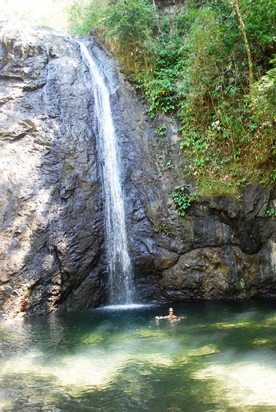
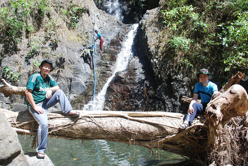
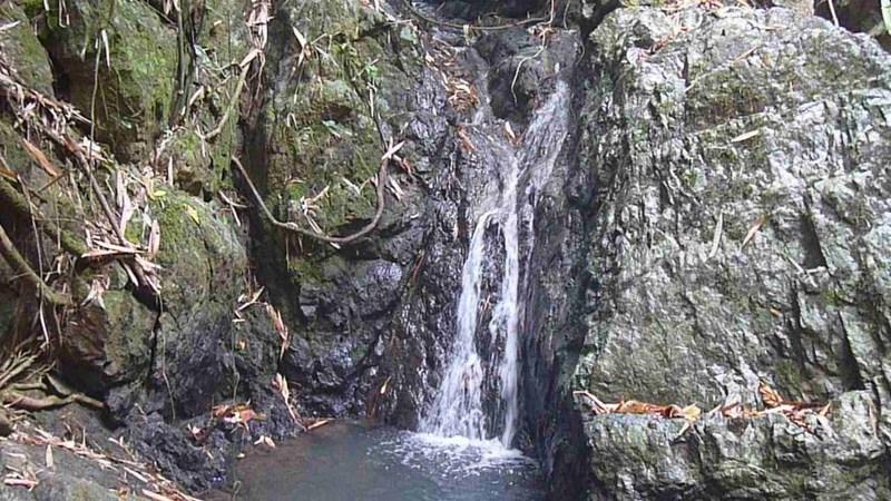
Upon arrival at Antipolo City, the first place Jandy and I visited was the 12 m. high Hinulugang Taktak, one of the two most popular tourist spots in Antipolo City, the other being the Antipolo Cathedral, and the nearest waterfall to Metro Manila. Officially the Hinulugang Taktak Protected Landscape, it was formerly called the Hinulugang Taktak National Park, declared as such by the Department of Environment and Natural Resources (DENR).
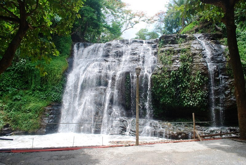
Hinulugang Taktak Falls
According to legend, there was a large bell that caused undue disturbance whenever it was rung at Angelus. Its sound was so loud that the people could not endure it. They demanded that the local priest get rid of the bell. They threw it at the waterfall. Thus, “Hinulugang Taktak” means “the place where the bell was dropped.”
Historical accounts say that our National Hero Jose Rizal frequented this falls. On June 15, 1952, it was declared a recreation area by then Pres. Elpidio Quirino and, in 1990, the waterfall was proclaimed as a National Historical Shrine by the National Historical Institute (NHI) by virtue of Republic Act No. 6964. It became an integral part of the country’s system of protected areas under Republic Act No. 7586, the National Integrated Protected Areas System (NIPAS) Act of 1992. It is now under the control of the DENR by virtue of Proclamation No. 42 and it’s area has been expanded from 0.89 hectares to 3.2 hectares.
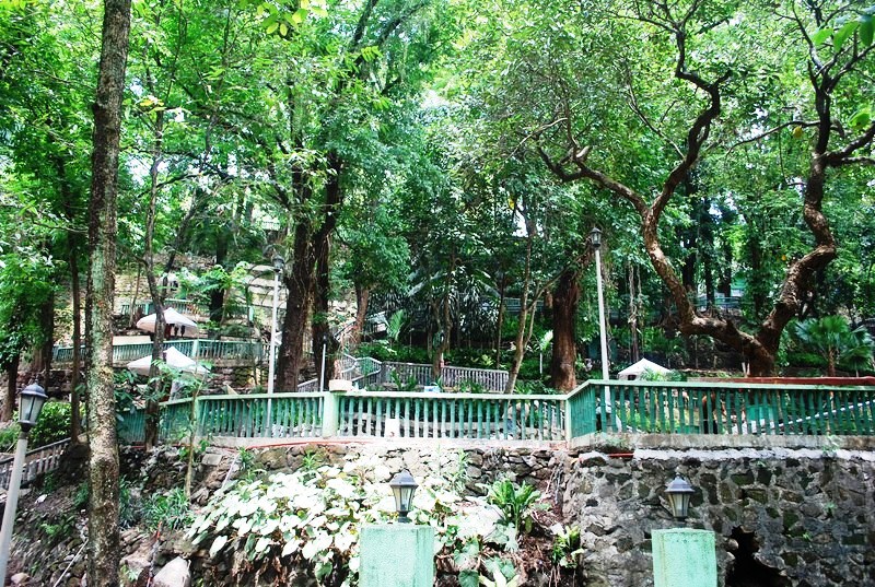
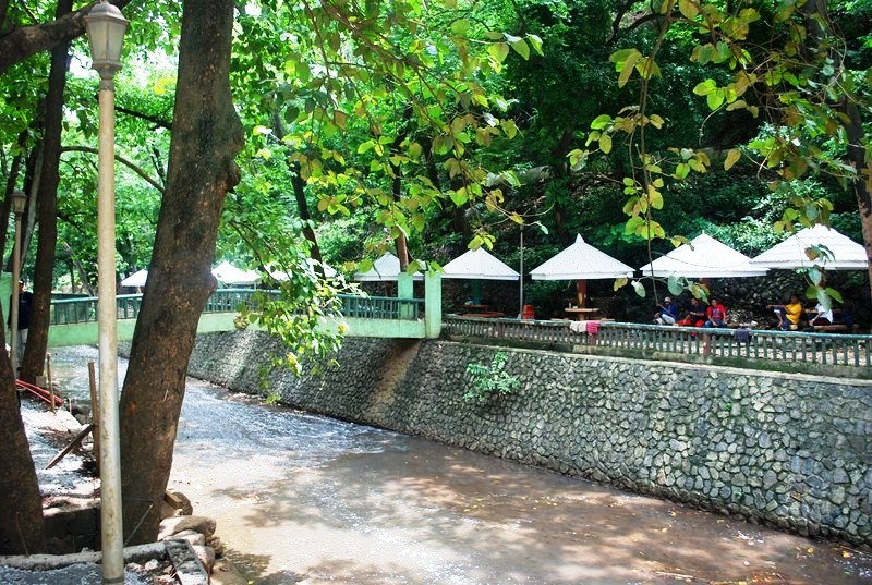
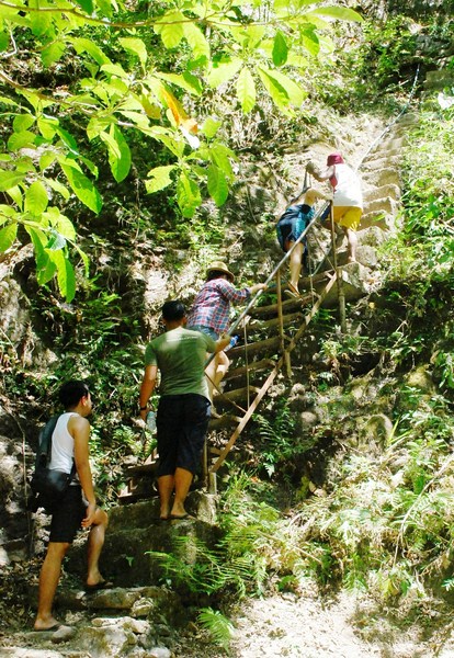
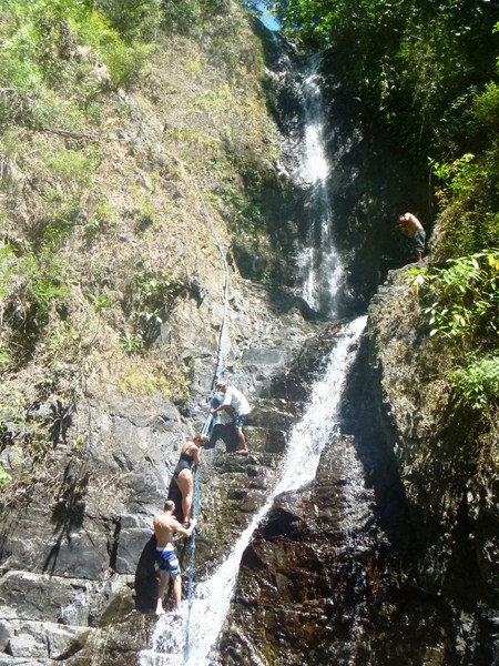
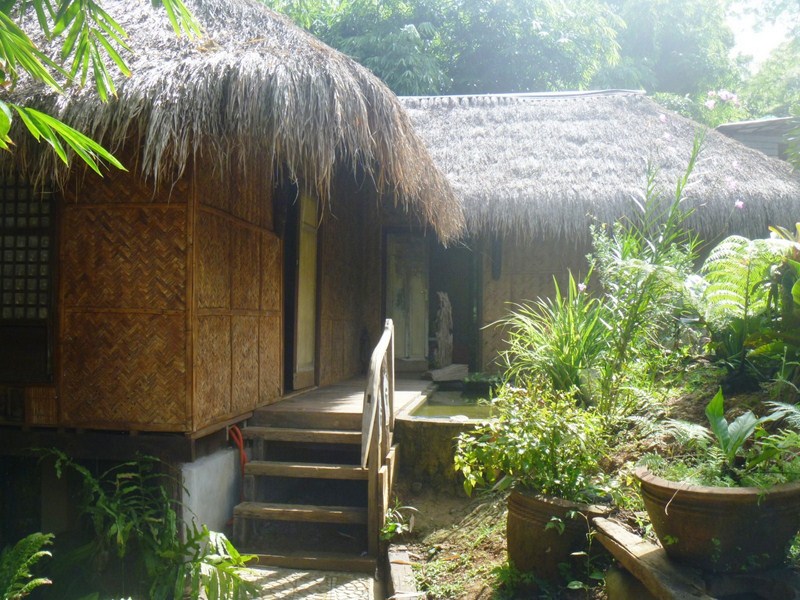
The park was closed to the public and undergoing rehabilitation when we arrived but we were allowed in by the caretaker. We went down a series of concrete steps flanked by kupang, acacia, ilang–ilang and mahogany trees. There are also cottages, common barbecue pits, public toilets and swimming pools.
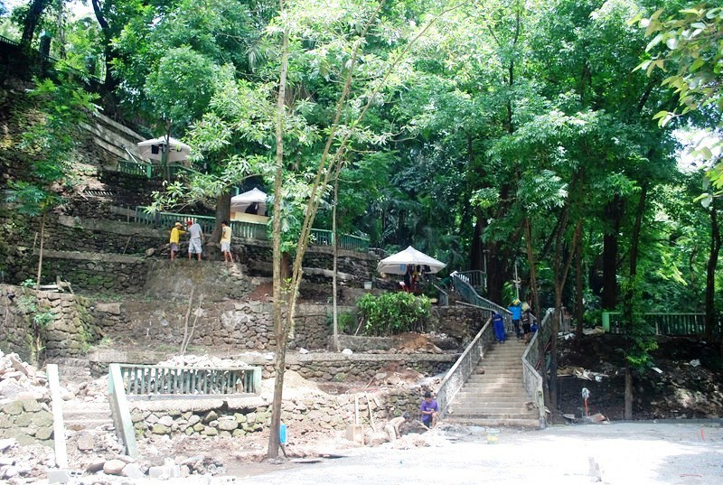
Concrete walkways and stairways
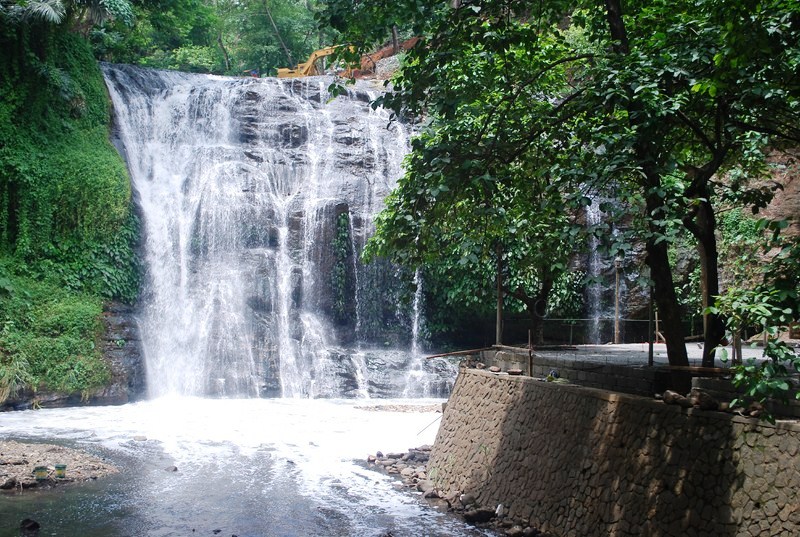
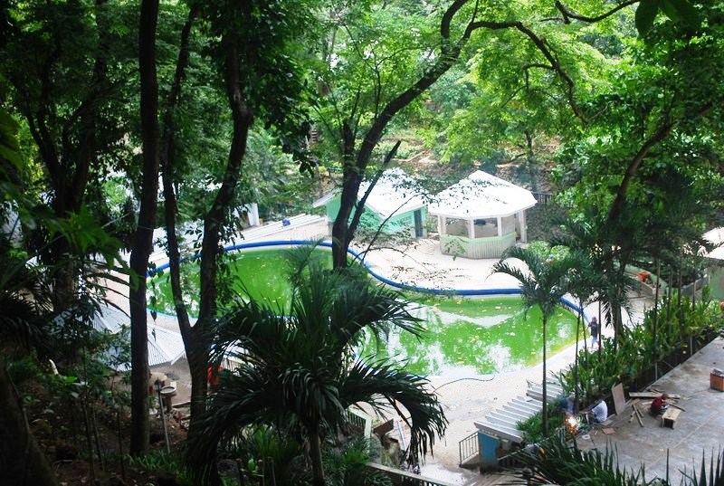
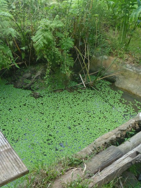
When we arrived at falls’ basin, I was greeted by an awful smell and the sight of a pool with waters thick with foam and soap suds (from detergent diluted in dirty water), more like a giant washing machine. At its fringes are raw waste, sewage and assorted garbage, coming from illegal settlers and some of the city’s drainage systems, which flow into the river and its tributaries (including the Pasig River), all prey to rapid urbanization. As such, its waters are polluted and not suitable for swimming (visitors here just use the swimming pool located downstream). The falls is just for viewing.
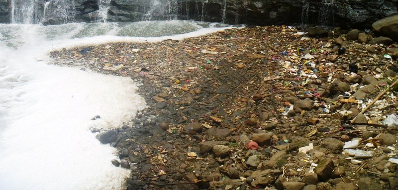
Garbage and foam at basin
However, the city government and the DENR are now working with private groups for a PhP100 million makeover, in 10 to 20 years, to restore and preserve the glory and natural beauty of this once famous and idyllic waterfall.
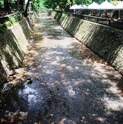
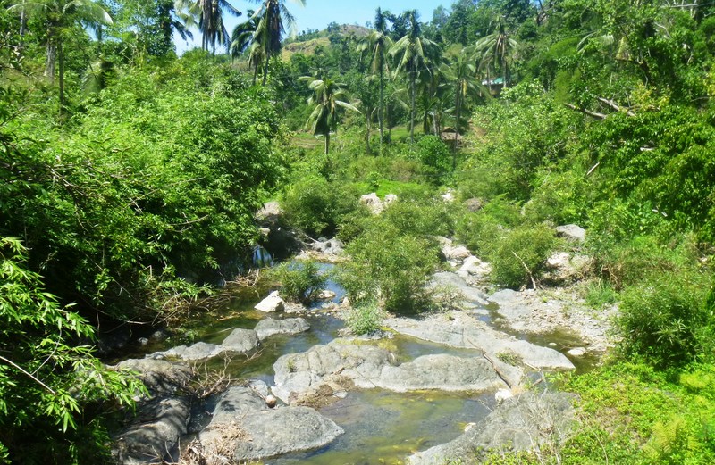
Downriver from the falls
Hinulugang Taktak was the subject of a bouncy native song (Tayo na sa Antipolo) composed by German San Jose (Gerry Brandy) of Malate, Manila. This song captures the now unpracticed tradition, as part of the pilgrimage to the Shrine of Our Lady of Peace and Good Voyage, of taking an excursion to the falls. Its lyric are as follows: “Tayo na sa Antipolo at doon maligo tayo. Sa batis na kung tawagin ay Hinulugan Taktak.”
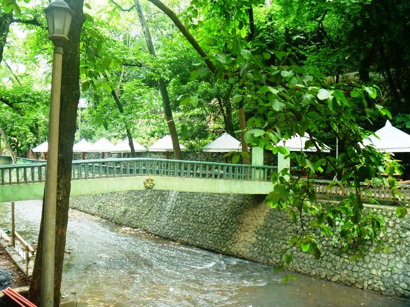
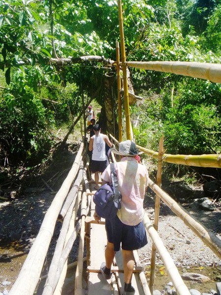
Bridge over the river
The basin is regularly cleaned but this is an exercise in futility as illegal settlers upstream continuously throw garbage. Studies to clean the water included putting up fences along the river, diverting the dirty water (and using artificial water for the falls) or setting up a filter to clean the water before it drains into waterfall, but these ways only tolerate those who throw the garbage. They have to make the people realize the importance of Hinulugan Taktak and that saving it is everybody’s responsibility. They have to CHANGE people’s attitudes.
The swimming pool
Picnic huts along the riverbank
Hinulugang Taktak Protected Landscape: Taktak Road, Brgy. Dela Cruz, Antipolo City, Rizal. Email: admin@hinulugangtaktak.com. Admission: PhP8 per pax, additional PhP15 per pax if you use the swimming pool.
City Tourism Office: City Hall, Antipolo City, Rizal. Tel: (632) 630-6974, (632) 697-1021 & (632) 644-2837.
How To Get There: Antipolo City is located 29.45 kms. from Manila. The city is accessed by 3 routes: from Marikina via Sumulong Highway from Cubao Quezon City; via Marcos Highway (which extends to Quezon Province) through the Marikina-Infanta Road; and from Makati City and San Juan via the Ortigas Ave. Ext.. Jeepneys to Antipolo City are available in Cubao (Quezon City). Upon reaching Taktak Rd., alight and then take a tricycle or walk towards the falls.


.JPG)
.JPG)

.JPG)
.JPG)


.JPG)
.JPG)

.JPG)
.JPG)
.jpg)

.JPG)
.JPG)
.JPG)


.JPG)
.JPG)
.JPG)
.JPG)
.JPG)
.JPG)
.JPG)
.JPG)
.JPG)
+-+Copy.JPG)
.JPG)

.JPG)
.JPG)