Balete Pass Tourism Complex (Santa Fe, Nueva Vizcaya)

After breakfast at Mrs. Gaddi’s Restaurant and some pasalubong shopping, we all boarded our Toyota Grandia van for our 6-hour return trip to Manila.  Along the way, we made a stopover at Balete Pass Tourism Complex, near the Nueva VizcayaNueva Ecija border, driving all the way up to the view point at the summit which is around 3,000 ft. (910 m.) in elevation.

Balete Pass

Balete Pass

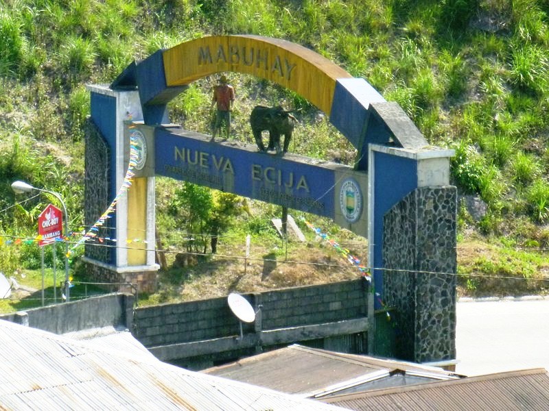
Nueva Ecija Welcome Arch

Nueva Ecija Welcome Arch

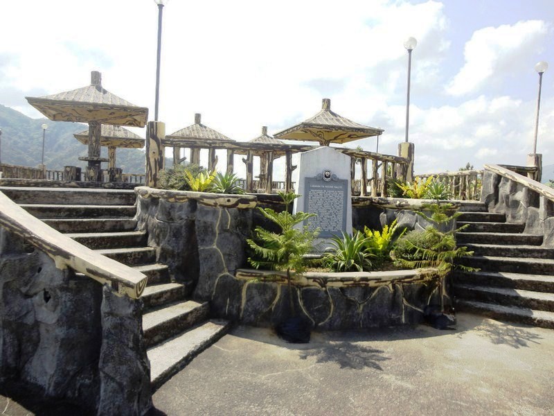
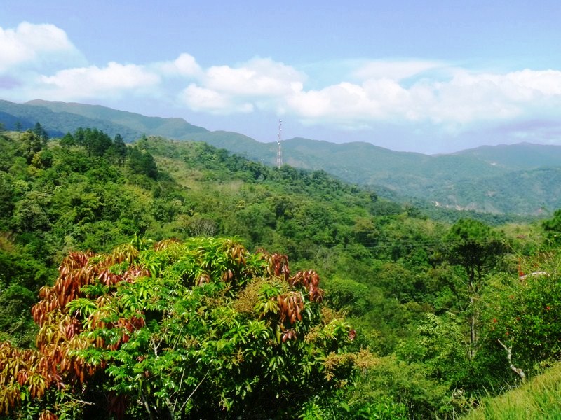
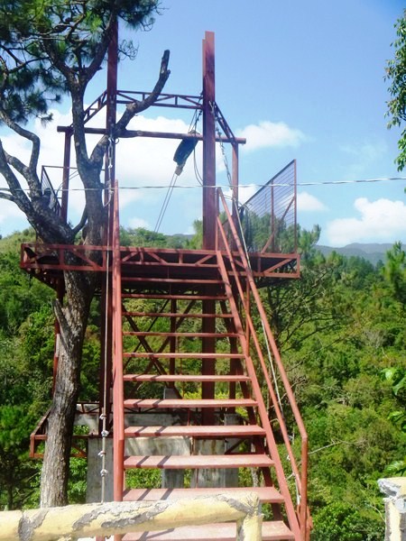
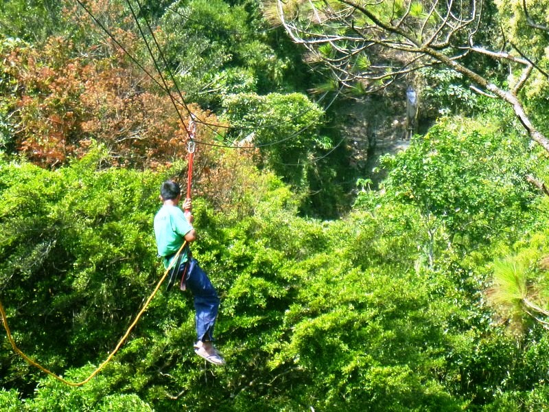
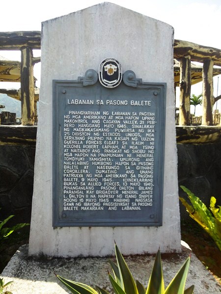
The viewpoint has a number of picnic sheds and a plaque installed by the National Historical Institute.  An 800 m. long  zipline facility, currently being built was, according to Mr. Regie Catalbas, the complex manager, to open in a few weeks time. At the view deck, we had panoramic views of the Caraballo Sur  and the Sierra Madre Mountain Ranges as well as the headlands of both the Cagayan River and the Pampanga Valleys.

Balete Pass Tourism Complex

Balete Pass Tourism Complex

Balete Pass, also called Dalton Pass, is a gateway to the Cagayan Valley, and the Ifugao Rice Terraces. The headwaters of the Digdig River originate just south of the pass. Balete Ridge starts two miles to the west-northwest of the pass, with a high point at the 5,580 ft. high Mt. Imugan and extends 9 miles to the east-southeast, where it ends at the 4,600 ft. high Mt. Kabuto.

View of Caraballo Sur and Sierra Madre Mountains

View of Caraballo Sur and Sierra Madre Mountains

Zipline platform

Zipline platform

Zipline dry run

Zipline dry run

The pass was the site of the “Battle of the Skies,” fought in 1945, between the pursuing 25th U.S. Army and Filipino guerillas (under the command of Maj.-Gen. Charles L. Mullins) and the Japanese 10th Division (under the command of  Lt.-Gen. Yasuyuki Okamoto), the rear guard of the Japanese Army retreating to the river mouth to the north.  About 7,750 Japanese soldiers, 285 Filipino guerillas and 685 Americans soldiers, including Brig.-Gen. James L. Dalton II (after whom the pass was initially named), the assistant division commander who died from a sniper’s bullet, were killed in the battle.  The Americans took the Balete area on May 31, 1945.

Plaque installed by National Historical Institute (NHI)

Plaque installed by National Historical Institute (NHI)

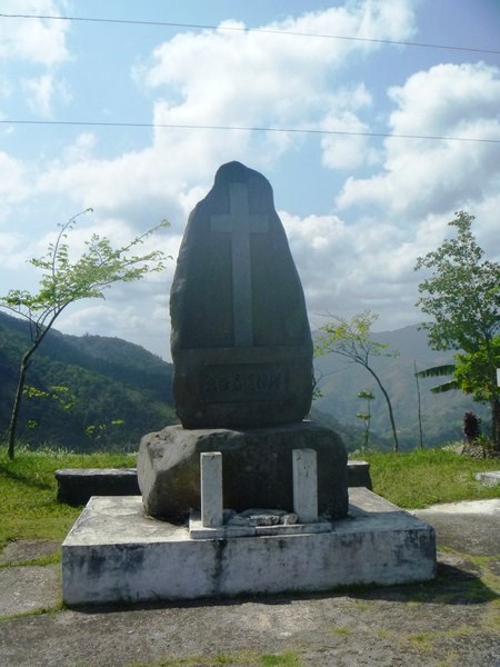
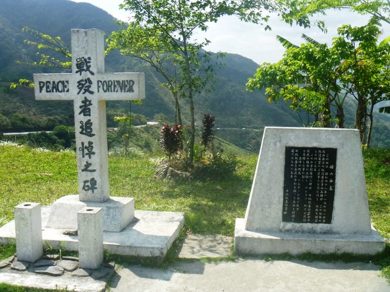
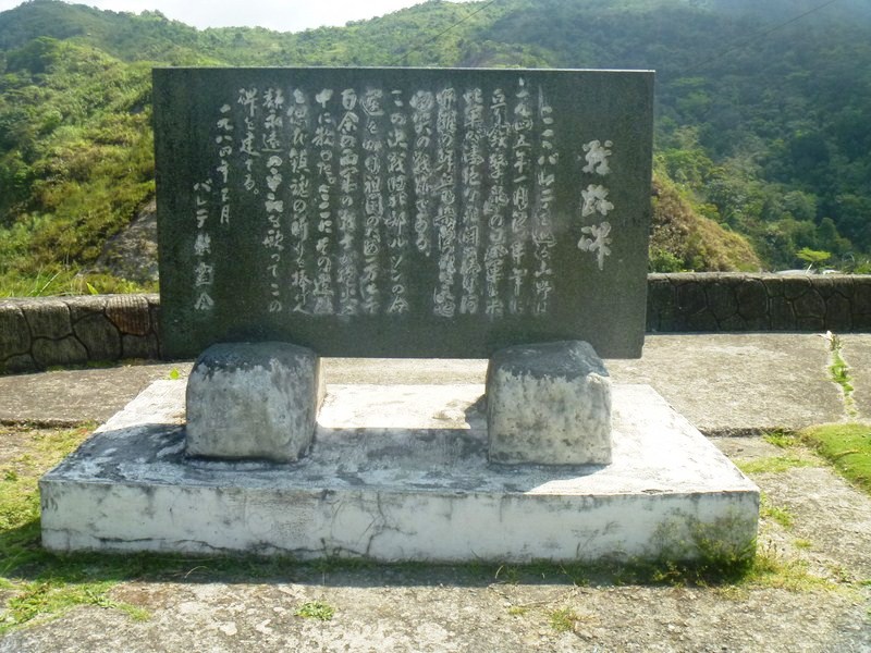
There are three memorials, representing 3 nationalities (American, Japanese and Chinese), at the site.  We passed by two of these shrines.  The first shrine we visited was the Japanese shrine and monument.  Established by families and fellow soldiers of the fallen, it has several plaques, engraved stones and a cross with the inscription “Peace forever.”

Japanese Shrine (1)

Japanese Shrine (2)

Japanese Shrine

Japanese Shrine

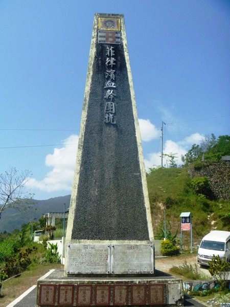
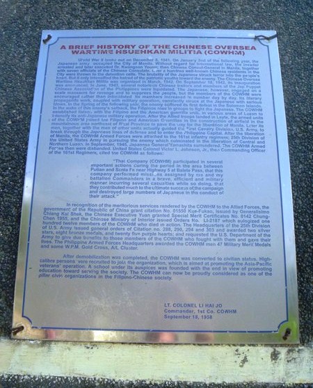
Just below the Japanese shrine is the Chinese shrine dedicated to the 8 Chinese Overseas Wartime Hsuehkan Militia (COWHM) soldiers ho died at Balete Pass, fighting with the Americans and Filipinos. The memorial has extensive text about the origins of the COWHM and a small marker plaque, dedicated on May 7, 2001, for each of the 8 soldiers who died.

Chinese Shrine

Chinese Shrine

The memorial plaque reads: “Dedicated to the memory of our 8 comrades-in-arms, who fought alongside Allied liberating army (25 Division, 161 Infantry) and paid the supreme sacrifice during mop-up operations in the summer of May 1945, against retreating Japanese forces at Santa Fe, Nueva Vizcaya. May their brave heroic efforts in fighting for freedom serve as a shinning model for all peace loving men and women for all times to come. Ex-Chinese Overseas Wartime Hsuekan Milita (EX-COWHM).”

Chinese Shrine plaque

Chinese Shrine plaque

The American shrine, the one shrine we didn’t visit, has a simple 12-ft. high obelisk and a bronze plaque at the base of the monument area that reads “Erected in honor of those soldiers of the 25th Division who sacrificed their lives in winning this desperate struggle.  In taking this pass 7,403 Japs counted killed. 2,365 US Army 25th Divison killed and wounded. May 13, 1945.”

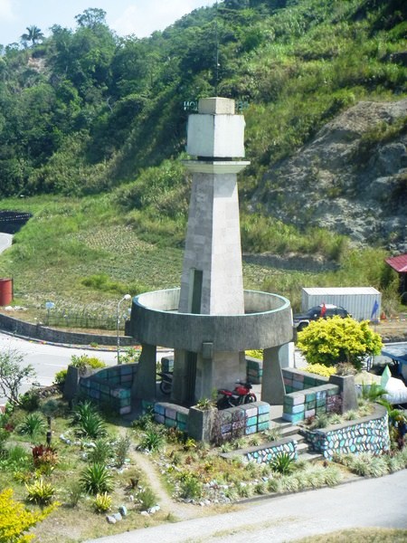
Lookout tower for Region 2

Lookout tower for Region 2

Behind it, just behind the memorial ridge line, is the small, unrelated DPWH/Perez Park, a memorial park with a lookout tower for Region 2, a 150 mm. Japanese howitzer and, directly behind the gun, the entrance to a large natural cave presumably used by the Japanese.

Dampol Bridge (Dupax del Sur, Nueva Vizcaya)

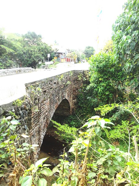
The nearly two century old, single arch Dampol Bridge

The nearly two century old, single arch Dampol Bridge

While my media colleague  Alexis Romero was busy interviewing Fr. Ferdinand E. Lopez at the Church of St. Vincent, I walked a short distance to Dampol Bridge which was said to have been built at the same time the church was being built.  Most tourists and some locals pass by it and don’t know that they are stepping upon or driving on one of Dupax del Sur’s historical treasures.

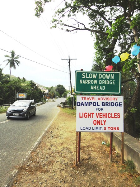
Approach to Dampol Bridge

Approach to Dampol Bridge

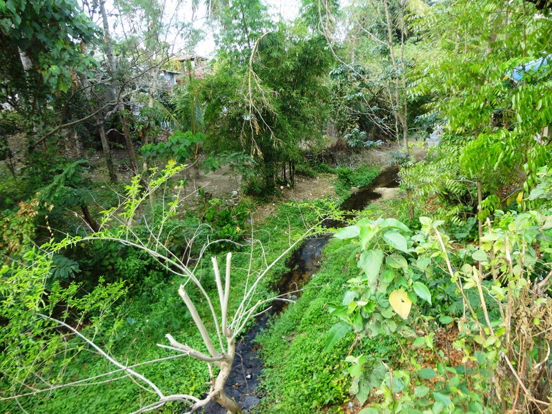
This nearly two century old, single arch unreinforced bridge that spans the Abanatan Creek which divides Brgy. Dopaj and Brgy. Dumang, was built in 1818 by the Isinai and other indigenous groups living in the area.  Its red-colored bricks were made from an old adobe workshop near the church, when Spanish Dominican friar Fr. Francisco Rocamora was vicar.

Abanatan Creek

Abanatan Creek

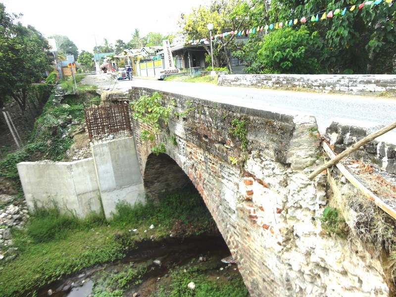
During a road construction and widening project undertaken by the DPWH -Nueva Vizcaya 2nd District Engineering Office in 2014 (who regarded the bridge as part of the National Highway), this important cultural and historical landmark was spared from demolition after an outcry from the Isinai community, but not after part of the protective brick wall had already been taken down in sections, exposing the inner filling to decomposition.

The damaged portion of the bridge

The damaged portion of the bridge

Today, only light vehicles (load limit: 5 tons) such as cars are allowed to cross the bridge, one at a time.  A suggestion to re-route traffic away from Dampol Bridge is now being considered.
Church of St. Vincent Ferrer (Dupax del Sur, Nueva Vizcaya)

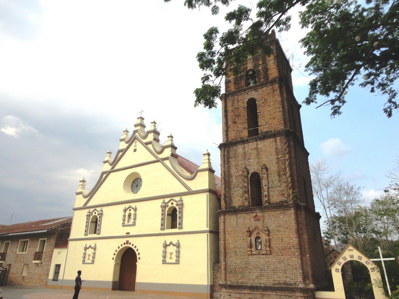
After covering the Kalanguya Festival, Roel, Alex and I boarded our van for the 2-hour trip to the town of Dupax del Sur where we dropped by its Church of St. Vincent Ferrer,  one of the oldest and biggest churches in North Luzon and the best-preserved church complex in Nueva Vizcaya. Here, we met up with parish priest Fr. Ferdinand E. Lopez.

Church of St. Vincent Ferrer

Church of St. Vincent Ferrer – a National Cultural Treasure

Declared a National Cultural Treasure by the National Museum of the Philippines in July 2001, this 18th-century  church,  under the advocation of Saint Vincent Ferrer (though its original titular patron was  the Nuestra Señora del Socorro), is under the jurisdiction of the Roman Catholic Diocese of Bayombong.

The 4-level, rectangular brick bell tower

The 4-level, rectangular brick bell tower

Made of brick, lime, coral or river rock and wood plastered over with stucco, the church covers an area of 7,200 sq. m. and its architectural design is similar to that of St. Peter Cathedral in Tuguegarao City, only less in ornamentation and lower in height with no spiral columns and pilasters to offer support to the structure.

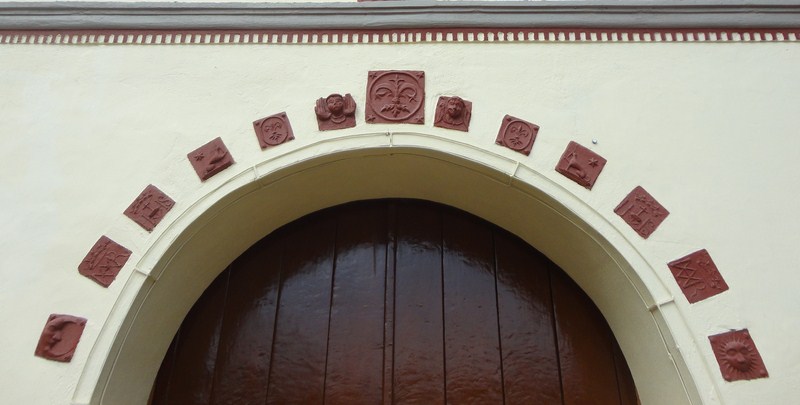
The semicircular arched main portal, embellished with clay insets

The semicircular arched main portal, embellished with clay insets

The present structure (an earlier church structure of modest design might have been erected before 1773), built by Dominican Fr. Manuel Corripio, OP with brick in 1776, mimics the silhouette of the earlier Tuguegarao Cathedral and is reflected on the churches of Bayombong and Bambang. During its construction, Fr. Corripio had two kilns made near the church complex, one for firing bricks and the other for preparing lime.

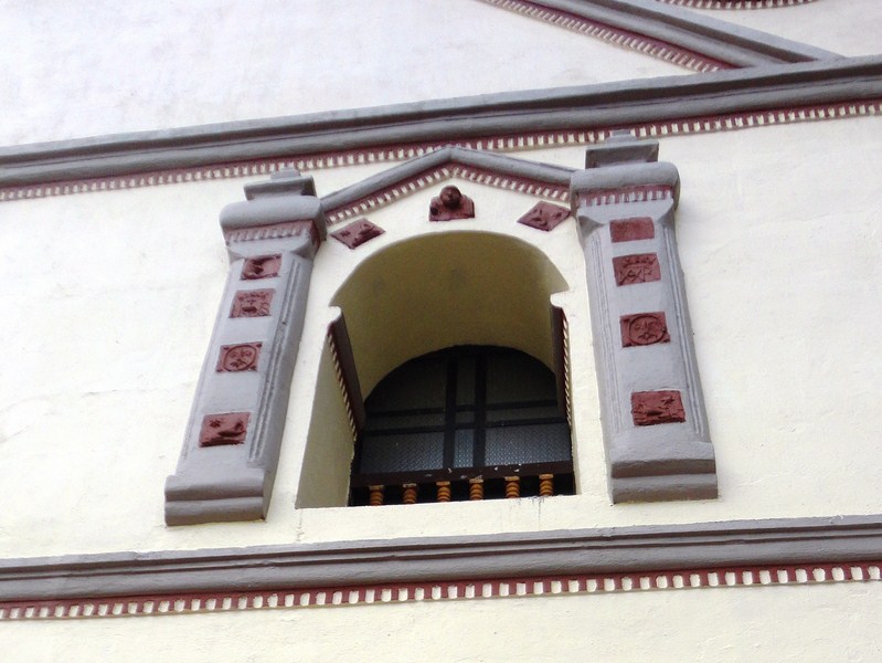
Window framed by embossed carvings

Window framed by embossed carvings

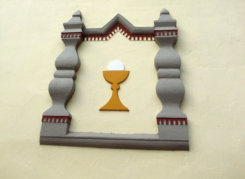
The Baroque-style façade, divided by cornices into horizontal segments of plastered brick,  features a semicircular arched main portal, embellished with clay insets (representing symbols of the Dominican Order), and a main doorway flanked on both sides by two blind windows with an embossed image of the Holy Eucharist, all  at the first level.  The second level features a niche and two windows framed by embossed carvings.

Blind window with an embossed image of the Holy Eucharist

Blind window with an embossed image of the Holy Eucharist

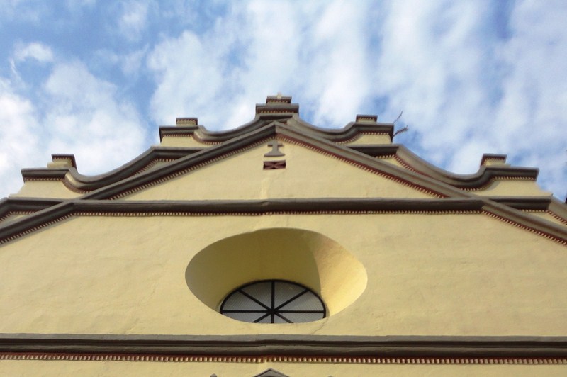
The entire triangular pediment, divided into two horizontal sections, is capped by undulating cornices and 7 finials, with the central finial crowned with a cross.  The lower half is pierced by a deeply-recessed oculus  while the upper part features a small relief of a cross.

The triangular pediment

The triangular pediment

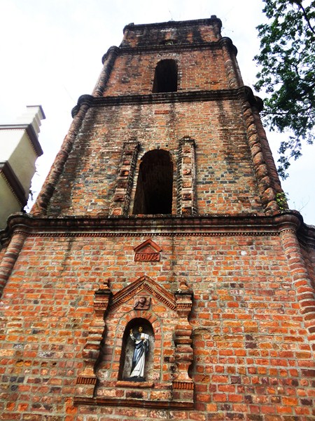
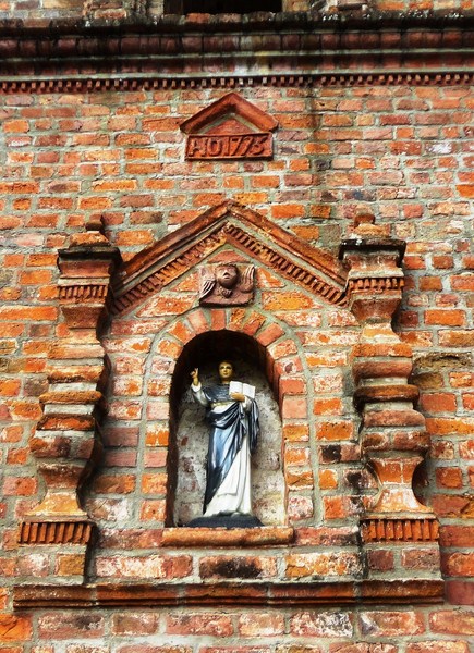
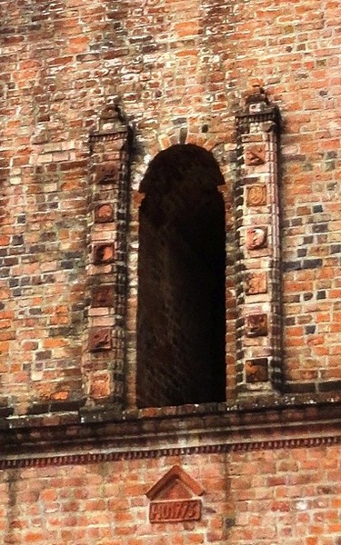
To the right of the façade is the unplastered, 4-level, rectangular bell tower whose base features a niche with the statue of St. Vincent Ferrer, similar to that found on the second level of the façade.  The tower’s second level features long, narrow windows framed with bracket columns. It is capped with a decorative parapet and a small cupola surmounted by a cross.

Niche with the statue of St. Vincent Ferrer at the bell tower

Niche with the statue of St. Vincent Ferrer at the bell tower

Long, narrow windows framed with bracket columns

Long, narrow windows framed with bracket columns

Each level bears inscription of the years when it must have been completed. We climbed all the way to the top of the tower via a very narrow, dark and steep stairway.  Two of the four bells were cast in 1858 and 1888. Up on the tower, we had a panoramic view of the whole town and the mountains of the Sierra Madre.

View of the town and mountains from the bell tower

View of the town and mountains from the bell tower

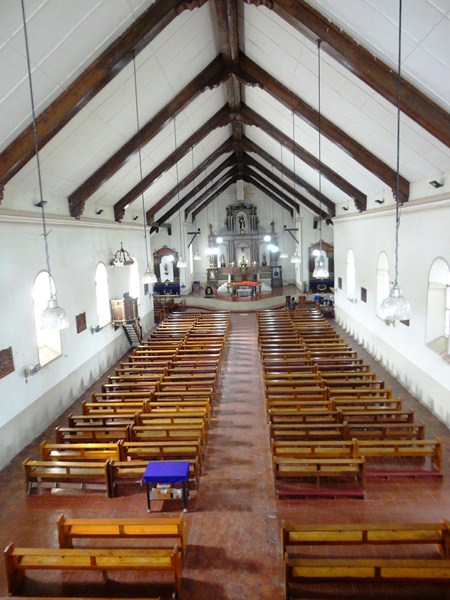
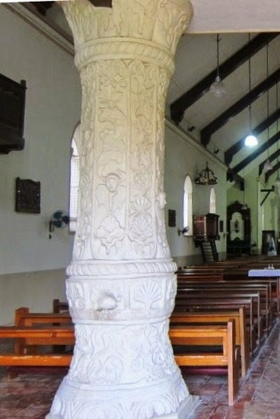
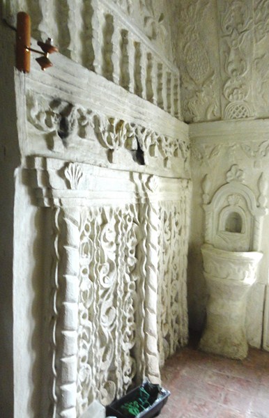
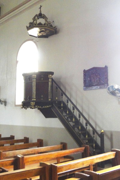
Inside the church are two, white-washed narthex pillars, supporting the choir loft, embellished with finely-carved stucco reliefs of cherubs, shells, florals and arabesques. Similar motifs can also be found on the baptistery. The original main retablo (altar backdrop) and pulpit are still intact but the heads of the statues in the retablo are believed to be just reproductions of the ivory ones stolen over the course of the church’s history.

The church interior

The church interior

White-washed narthex pillars embellished with finely-carved stucco reliefs

White-washed narthex pillars embellished with finely-carved stucco reliefs

The 2-storey church convent, connected to the church, still retains slits on the outer walls for archers to defend against attacks and target marauders. The church plaza is enclosed by a low perimeter wall and a replica of an earlier atrial cross.

The similarly ornate carvings in the baptistery

The similarly ornate carvings in the baptistery

Church of St. Vincent Ferrer: Aritao-Quirino Rd., Brgy. Dopaj, Dupax del Sur, 3707, Nueva Vizcaya.  Tel: (078) 808 1016.

The church pulpit

The church pulpit

How To Get There: Dupax del Norte is located 248.26 kms. from Manila and 26 kms. south of Bayombong.

Kalanguya Festival (Sta. Fe, Nueva Vizcaya)

The next day, after breakfast, we observed the beautiful and colorful parade of 16 floats (each representing a barangay) along the National Highway as wound its way to the Santa Fe Sports and Cultural Center at the town proper.

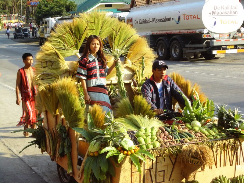
Brgy. Bantinan float

Brgy. Bantinan float

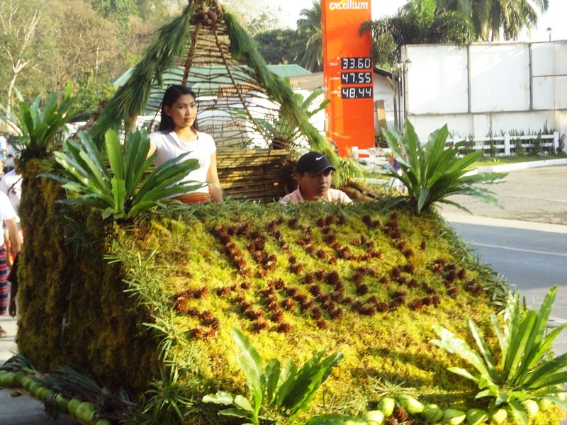
Brgy. Sta. Rosa float

Brgy. Sta. Rosa float

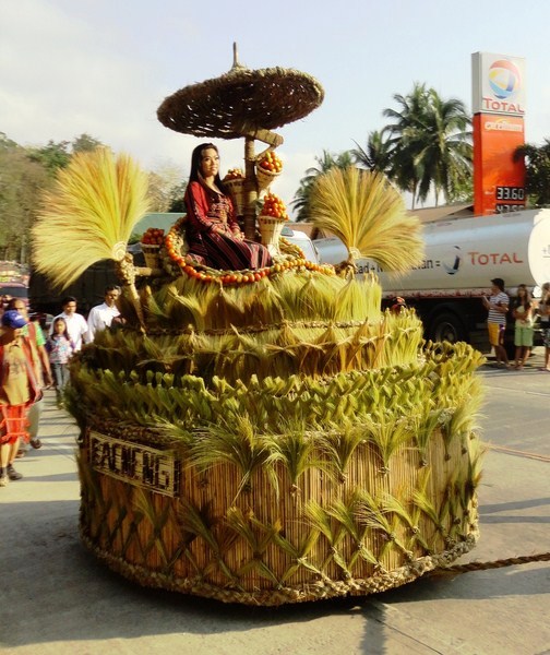
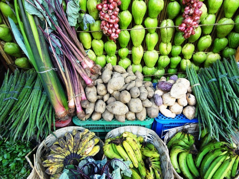
Each float had their barangay’s beauty candidate, wearing a Kalanguya costume, on board. Floats were also bedecked with the barangay’s farm produce (chayote, eggplants, tomatoes, carrots, sweet potatoes, ginger, bananas, pechay, pineapples, etc.), baskets, walis tambo (tiger grass brooms) and flowers.

The winning walis tambo-themed float of Brgy. Bacneng

The winning walis tambo-themed float of Brgy. Bacneng

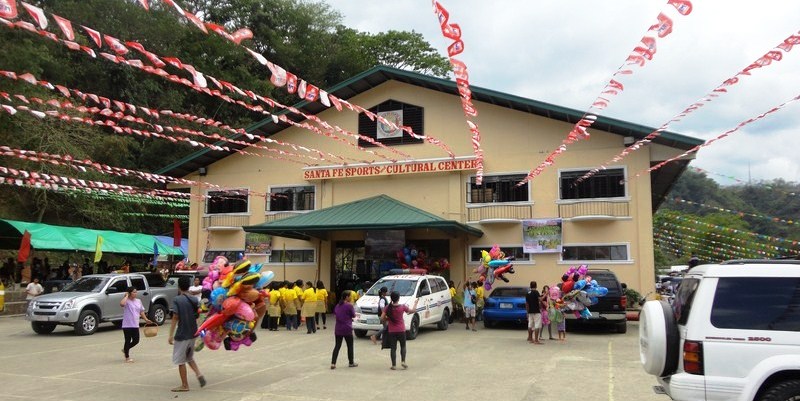
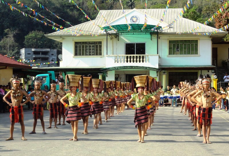
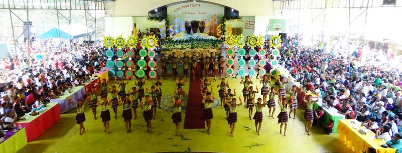
At the town proper, the street dancing competition unfolded with a street performance held in front of the municipal hall and the ground demonstrations at the Santa Fe Sports and Cultural Center.  Both showcased the Kalanguya’s costumes, dance and musical instruments.

Santa Fe Sports and Cultural Center

Santa Fe Sports and Cultural Center

Alexis, Roel, Ms. Lelia E. Blancaflor (DOT Region 2 acting director), Ms. Imelda A. Garduque, also from DOT Region 2, and I were asked to judge the competition.  We would also do so for the float competition. Three contingents – Kalahan, Canabaan National High School and Sta. Fe National High School presented story lines regarding a particular Kalanguya practice.

The street performance in front of the municipal hall

The street performance in front of the municipal hall

Ground demonstration

Ground demonstration

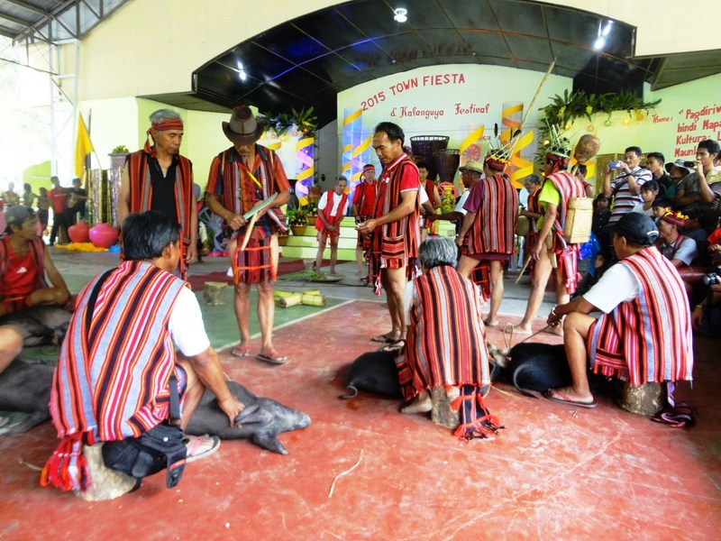
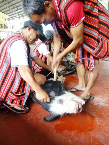
We also observed the padit, a grand canao (socio-religious celebration) ritual featuring the traditional (but shocking to others) butchering of pigs, native chickens and 2 carabaos.  These were then boiled and served to all attendees.  Tapey (native wine) was also served to guests while the bah-liw was chanted by tribal elders.

Kalanguyas performing the padit

Kalanguyas performing the padit

Later, officials, guests and barangay officials danced the tayaw, to the beat of gangha or gangsa (gongs). Indigenous sports such as bultong (wrestling), tug-of-war, bamboo pole climbing, wood chopping, gayang (spear throwing), hanggol (arm wrestling) and dapapnikillum (pig catching) plus tapey drinking and group chanting of the bah-liw were also featured.

A pig sacrifice

A pig sacrifice

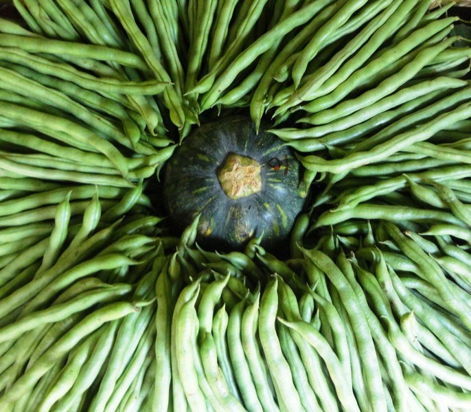
Within the festival venue are 16 booths selling jams and jellies made from guava, santol, bignay or wild berries; farm produce such as camote, gabi, vegetables, yakun, sayote, etc.; Ifugao handicrafts such as rattan baskets, woodcarvings; tiger grass soft brooms; and exotic and beautiful handwoven fabrics used as tapis by women and g-strings by the men.

DSC07496

DSC07504

Farm produce at the Agri-Tourism Fair

Farm produce at the Agri-Tourism Fair

Sta. Fe Municipal Hall: Poblacion, Sta. Fe, Nueva Vizcaya. E-mail: info@santafe.gov.ph. Website: www.santafe.gov.ph.

Imugan Falls (Sta. Fe, Nueva Vizcaya)

After checking in at Sta. Fe Forest Park, we still have free time before covering the Kalanguya Festival the next day so Rollie, Gener, Mon, Alex, Roel and I opted to explore the town’s Imugan Waterfalls, one of the town’s natural attractions. Ms. Ma. Theresa Farrah Dugay, Sta. Fe’s Municipal Tourism Officer assigned Mr. Emmanuel A. Caramat, Ms. Melany C. Lazaro and Mr. Regie Catalbas as our guides.

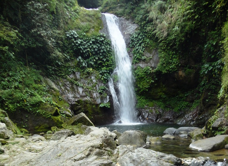
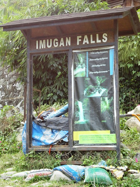
Imugan Falls

Imugan Falls

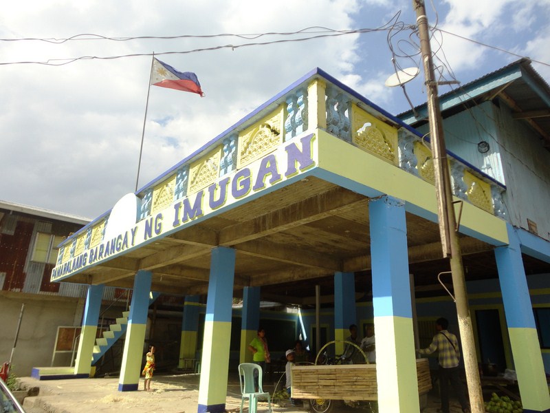
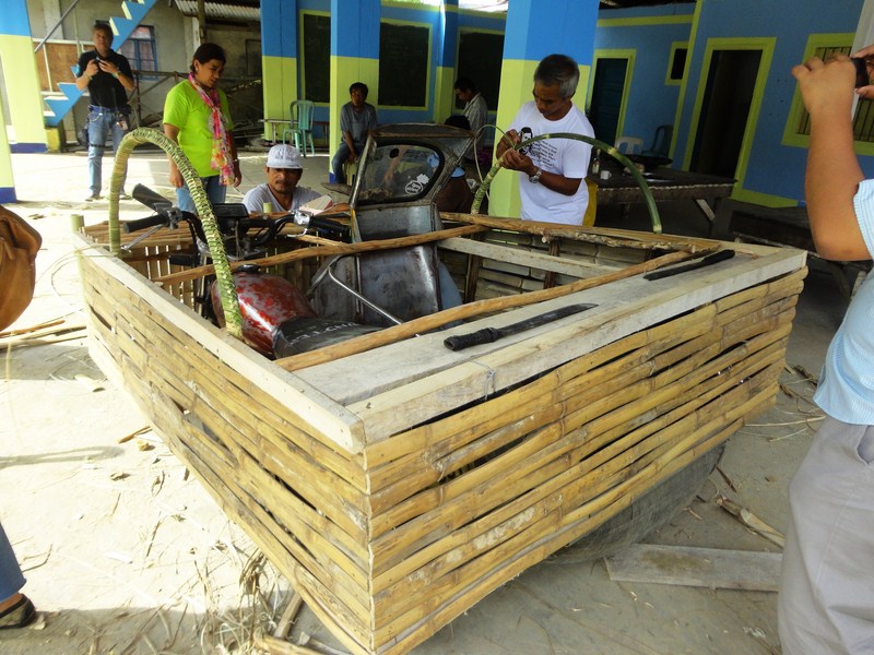
We all boarded our van for the 7-km./30-min. drive to the jump-off point at Brgy. Imugan for the hike to the falls, arriving there by 3 PM. At the barangay hall, we observed a float being prepared for the next day’s Kalanguya Grand Parade. Their float’s theme is centered on the ubiquitous, pear-shaped and light green chayote (Sechium edule, locally called sayote), the barangay’s principal produce.

Imugan Barangay Hall

Imugan Barangay Hall

Preparing a float

Preparing a float

Jump-off point to Imugan Falls

Jump-off point to Imugan Falls

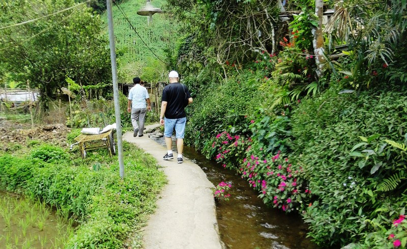
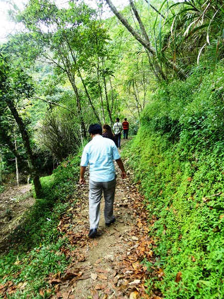
According to Emmanuel, the nearly 1-km. hike to the falls would take us around 30 mins. The initial part of our hike was along a cemented pathway between an irrigation canal with flowing spring water and newly watered rice paddies. After crossing a stream, we now traversed a narrow, leaf-strewn but mildly graded dirt trail through a light dipterocarp forest.

Initial hike along a concrete pathway between an irrigation canal nad rice paddies

Initial hike along a concrete pathway between an irrigation canal and rice paddies

Hiking a  narrow dirt trail strewn with dead leaves

Hiking a narrow dirt trail strewn with dead leaves

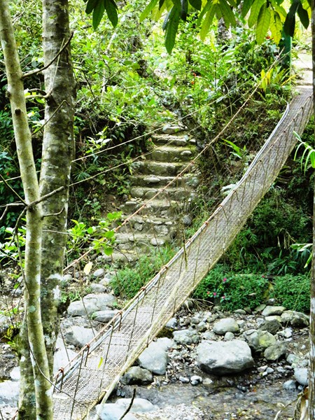
A hanging bridge

A hanging bridge

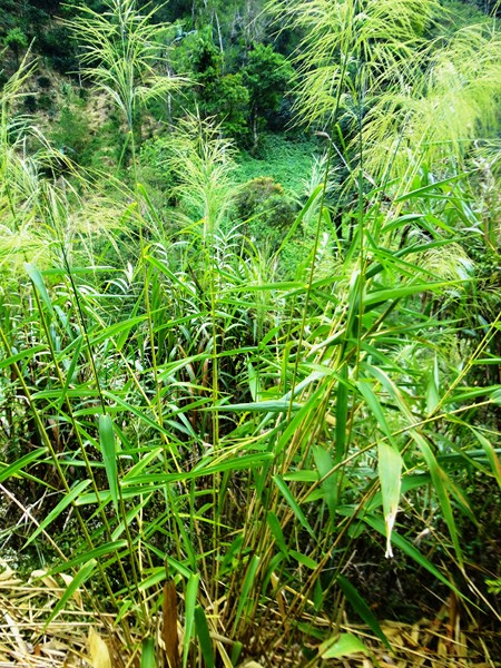
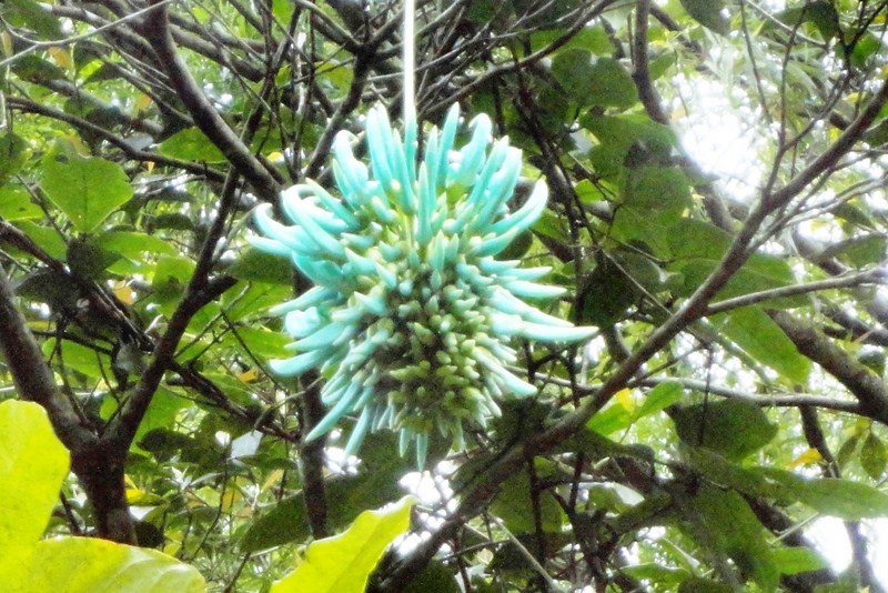
The hike was scenic all throughout, with views of a hanging bridge and the boulder-strewn stream emanating from the falls below us and, along the trail, of wild orchids clinging to trees, giant ferns and stems of tiger grass (scientific name: Thysanolaena maxima), used in the manufacture of the popular walis tambo or soft broom).

Tiger grass

Tiger grass

An exotic orchid

An exotic orchid

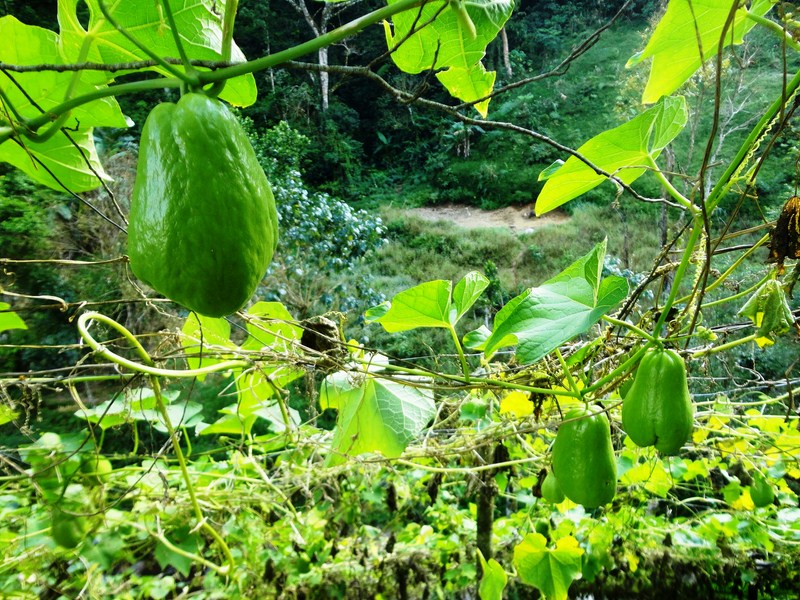
An orchard of sayote

An orchard of sayote

Also along the way we passed numerous orchards of sayote, all sprouting on vines clinging to a moderately-spaced mesh of G.I wire and supported on poles along the steep slope of the mountain side.

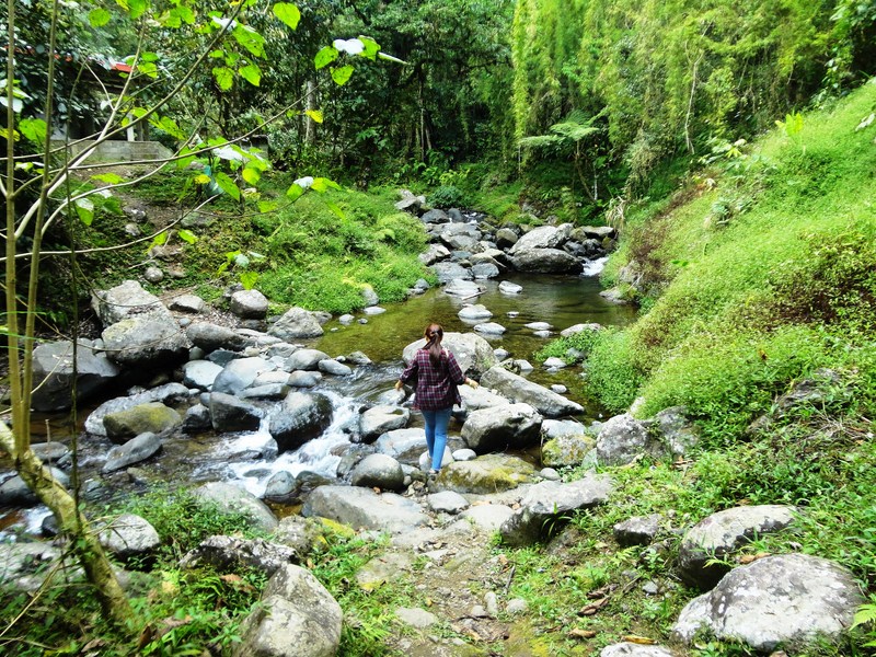
Melany crossing a boulder-strewn stream

Melany crossing a boulder-strewn stream

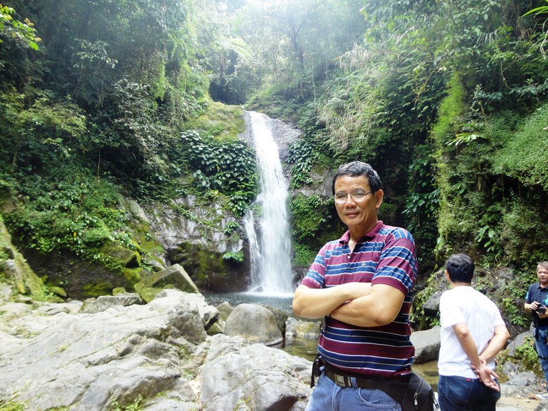
After rounding a U-shaped bend along the trail and crossing a stream, we soon heard the rush of falling water signaling our arrival at Imugan Falls which is located between two mountains in the Caraballo Mountain Range. With a height of about 35 ft. and falling in 2 levels, its refreshing mountain spring waters drop down into a shallow catch basin.

The author at Imugan Falls

The author at Imugan Falls

As we didn’t bring bathing attire, we didn’t swim its bracingly cold waters but we did savor its natural beauty, pristine setting and quiet surroundings. To the left of the falls are some rather steep steps carved into the rock face which, according to our guides, lead to the fall’s smaller first level which also has a basin. We passed on this opportunity though and, instead, made our way back to Imugan. Our hike to the falls was truly a fitting start to our visit to Sta. Fe.

Sta. Fe Forest Park (Sta. Fe, Nueva Vizcaya)

For the second time around, I was asked to cover the Kalanguya Festival (the first time was in March 15, 2003), now on its 20th year, in Sta. Fe, Nueva Vizcaya, joining a media group consisting of two other print media representatives (Roel Hoang Manipon, Asst. Editor of The Daily Tribune, and Alexis B. Romero, reporter of The Philippine Star) and three staff from the Department of Tourism (Rolando “Rollie” Cagasca, Ramon “Mon” Rebulado and Gener Carlos).

San Jose City (Nueva Ecija)

San Jose City (Nueva Ecija)

We all left Manila by 7:15 AM and the 216.85-km. trip took all of 6 hrs., including a stopover for lunch at a Chowking branch in San Jose City (Nueva Ecija). We arrived at the town by 1:30 PM and were warmly welcomed by Mayor Liwayway C. “Liway” Caramat and Municipal Tourism Promotion & Development Officer Ma. Theresa Farrah C. Dugay.

Ms. Ma. Theresa Farrah C. Dugay and Mayor Caramat

Ms. Ma. Theresa Farrah C. Dugay and Mayor Caramat

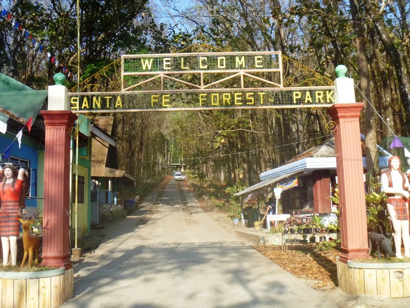
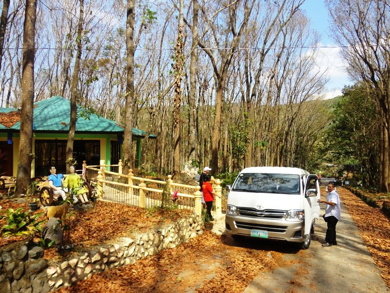
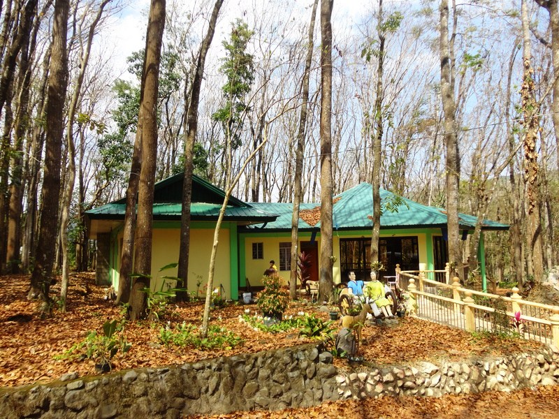
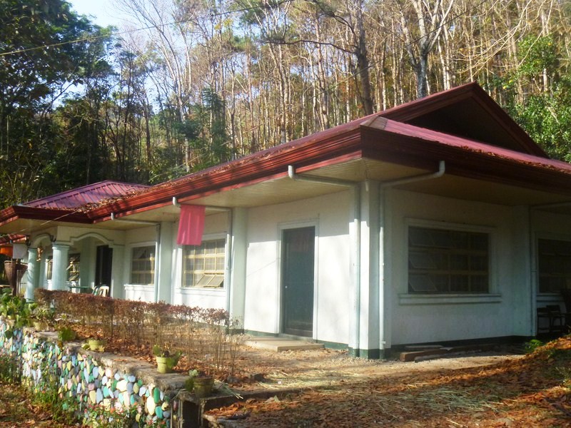
After our courtesy call on Mayor Caramat, , we were checked in at cottages within the 2,200-hectare Santa Fe Forest Park, a reforestation project with Benguet pine and West Indian mahogany (Swietenia mahagoni). The Grand Parade was to also start here and contingent members were billeted within buildings in the park.

Sta. Fe Forest Park

Sta. Fe Forest Park

Mahogany trees along the driveway

Mahogany trees along the driveway

The Santa Fe Forest Park was an erstwhile reforestation project of the DENR that commenced in the mid-1950s. It covers around 2,200 hectares of areas in Barangays Bacneng, Baliling Villa Flores and Poblacion. On September 22, 1997, the Sta. Fe Forest Park was established for nature-based tourism, covering about 1,000 hectares within the 11,664 ha Consuelo Reforestation Project.

Cottages

Cottages

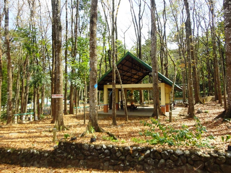
Multi-Purpose Hall

Multi-Purpose Hall

P1230744

The DENR, through a Memorandum of Agreement, handed over the management of the reforestation project to the LGU of Sta. Fe, which eventually paved towards the development of the erstwhile project into a forest park.

Enroute to Banaue (Ifugao)

Jandy and I were supposed to go on a beach camping and island hopping tour in Pagbilao (Quezon) but, at the last minute, my companions backed out and we were left with the possibility of, for the first time in a long while, of spending Holy Week at home.  While on Facebook come Wednesday morning, Ms, Violeta Imperial of Nature Awareness and Conservation Club appeared on chat and ask me where I was spending the holidays and, of course, I answered “nowhere.”  She offered her Sorsogon whale shark watching tour but, wanting to escape the oppressive heat of the city, inquired, instead, about her Sagada/Banaue tour.  There was only one slot left but Violet offered to check if there were Ohayami Bus (the only bus company plying the Manila-Banawe route) seats still on offer.    After about an hour, she told me I was in luck as the bus company had some “chance passenger” seats.

Our tour group

I returned to my usual packing, this time replacing beach wear with cold weather attire (jackets, woolen caps, etc.).  With our backpacks and a take-out Jollibee dinner and half a dozen Krispy Kreme doughnuts, Jandy and I were  brought to the bus terminal by my daughter Cheska and her boyfriend Marve by 8 PM.  Here, we met up with Ms. Jocie Dimaculangan, our tour coordinator, who also had, in her care, sisters Jessica and Jasmin Bez, Ms. Joy J. Tenedero, Ms. Desiree R. Benitez, Ms. Long R. Garcia, Ms. Eureka Joy Bueno, Ms. Diosa Diaz, married couple Lilia Kristina and Aldrin Tejada; and Mr. Donald Jesus G. Danao.

Our Ohayami bus

We soon boarded our bus and Jandy took his assigned seat while I waited for my “chance passenger seat” which turned out to be a plastic monobloc chair placed at the center aisle (there were 6 of us seated that way).  Truly, a first for me.  Our supposed-to-be 9 PM bus left the terminal by 9:30 PM and it had to negotiate holiday traffic to make it to the North Luzon Expressway (NLEX).  It was lights out by then and everybody on the regular seats were soon asleep.  It was a different case for us “chance passengers” as we had to stay awake in case the bus suddenly speeds up or stops.  How I envied the others. Jandy and I were soon wrapped up in our jackets and woolen caps as the bus airconditioning was set to high.

Save Oil Gas and Restaurant

Our bus had a long traffic spell somewhere in Baliwag (Bulacan).  Past that, we made our first stopover for peeing and meals at Sevilla Sweets and Restaurant at San Miguel (Bulacan) by 11 PM.  Afterwards, I somehow was able to get some shuteye until I was rudely awaken by the swaying of the bus as it negotiated the winding Dalton Pass in Nueva Vizcaya.  Now I had to hang on for dear life as my chair moved with each turn.  We made our second and final rest stop, by 4 AM, at the Save Oil Gas and Restaurant in Aritao (Nueva Vizcaya) where I had a cup of chocolate. Peeing at its clean restroom set us off by PhP5 each.

Nature Awareness and Conservation Club, Inc.: 18 Pioneer St., Moonwalk Village, Las Pinas City, Metro Manila.  Tel: (632) 801-1720. Mobile numbers: (0932) 243-9478 and (0915) 510-1600.  E-mail: Mother_Nature888@hotmail.com.

Ohayami Trans: cor. Lacson Ave. and J. Fajardo St., Sampaloc Manila.  Tel: (632) 516-0501. Mobile number: (0917) 561-7344.  E-mail: ohayami@ohayamitrans.com. Website: www.ohayamitrans.com.

Canili-Diayo Dam and Reservoir (Aurora and Nueva Vizcaya)

Canili-Diayo Dam

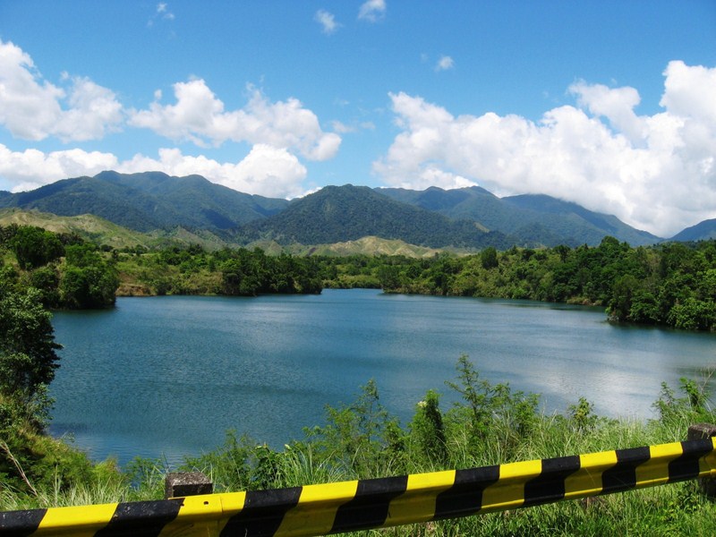
The Canili-Diayo Dam and Reservoir, a tributary of the  Pantabangan Dam, is probably the most picturesque irrigation dam in the country.  Situated on the border of Nueva Vizcaya and Aurora provinces, the Canili River Reservoir, on the left coming from Manila,  is part of the town of Alfonso Castaneda (Nueva Vizcaya) while the Diayo River Reservoir is part of Maria Aurora (Aurora).

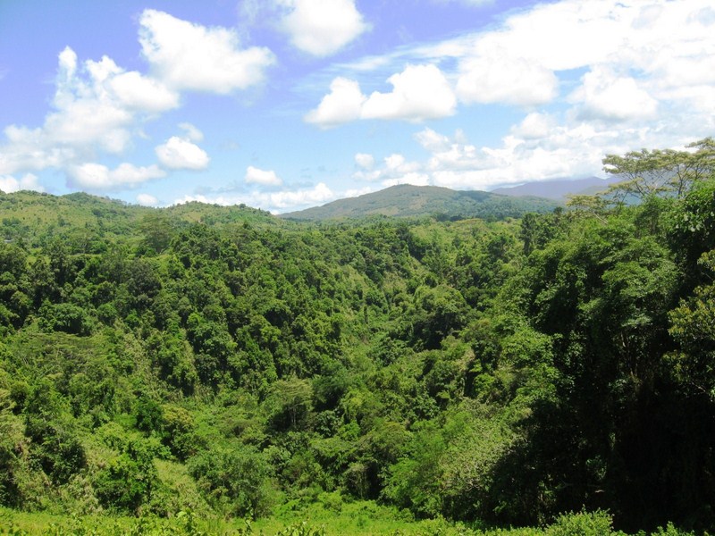
Great view of the mountains from the dam

The dam reservoir

Built in the 1970s, the dam’s earth dike is part of the Pantabangan-Canili-Basal-Baler Road.  This bypass road was originally a two-lane road but now access is restricted to one vehicle at a time to minimize vibration on the earth fill dam walls and protect the dam from deterioration. The direction of flow depends on who approached the other end on the road first.

The Pantabangan-Canili-Basal-Baler Road

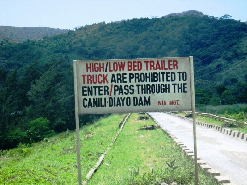
To prevent speeding, a number of humps were also placed on the road.  There is also a 10-ton vehicle weight limit being imposed. Trailers and large trucks are banned. Big trucks pass through the old route – Nueva Ecija-Aurora Road passing through Bongabon town (Nueva Ecija) and San Luis town (Aurora).

On the Road to Baler

Canili-Diayo Dam (Alfonso Castaneda)

Baler, the provincial capital and center for trade and industry of Aurora province, recently hit it big when its namesake movie Baler won Best Picture and a host of other awards in last year’s Metro Manila Filmfest, its plot based on the 337-day (June 27, 1898-June 2, 1899) siege of its Spanish garrison by Filipino rebels.  When it finally surrendered (the last to do so in the country), Gen. Emilio Aguinaldo, in admiration, declared, on June 30 (now Philippine-Spanish Friendship Day), that the remaining 33 Spanish soldiers were not be imprisoned but honored as friends.  Me and my family watched it and, being actually filmed on location, I was also impressed by its rugged scenery and decided to visit it, doing so on Holy Week.  Joining me were my two kids, Jandy and Cheska, plus lady friends Ms. Lourdes “Lulu” Siguenza and Ms. Rosevie “Vi” Sevilla, an avid photographer.

As we left Manila late afternoon of April 8, Wednesday.  Traffic was relatively light considering it was the eve of the Holy Week break but, once out at the North Luzon Expressway (NLEX), I took the wrong exit and was, instead, on our way to Zambales before I realized my mistake and backtracked, losing valuable time (not to mention the gasoline) in the process.  Dinner was at a Chowking outlet at a rest station along NLEX.  Late evening caught us in San Leonardo, Nueva Ecija, and tired from all these misadventures, decided to call it a night, pulling into a roadside drive-in motel.  I was speechless when Cheska inquired as to the strange furniture as well as the bathroom with the see-through glass in our room.

Camp Pangatian

Come morning, we continued on our way and made a short stopover, along the Cabanatuan-Palayan Rd., at Camp Pangatian, 8 kms. from Cabanatuan City.

Check out “Pangatian War Memorial

Provincial Capitol (Palayan City)

There are 2 routes to Baler – the Baler-Bongabon (Nueva Ecija) Road and the longer Pantabangan-Canili Road. As the former was impassable during the rainy season, we opted for the latter.  Just the same, at least 20 kms. of the trip was along gravel roads at Alfonso Castaneda (Nueva Vizcaya), the last town before entering Aurora province.  Here, we made photo op stopovers at Pantabangan Lake (a man-made lake resulting from the construction of the Pantabangan Dam) and its tributary, the Canili-Diayo Dam and Reservoir, probably the most picturesque irrigation dam in the country.

Check out “Canili-Diayo Dam and Reservoir


Millennium Tree

We entered Aurora province at Maria Aurora town (the province’s biggest).  Here, we made another stopover at  Balete Park and its star attraction – the Millennium Tree, a  massive, 49-m. high, 10-15 m. wide balete tree.

Check out “Millennium Tree

Kalanguya Festival (Sta. Fe, Nueva Vizcaya )

Northern Luzon is a prime tourist destination in the Philippines.  The Cagayan Valley, with its rich cultural heritage and stunning geographic diversity  of scenic mountain ranges and valleys, is one of the most beautiful and exciting of these destinations and Nueva Vizcaya offers both man-made and natural wonders (the legendary Salinas Salt Spring of Bambang, the amazing Alayan-Kapisaan Cave System of Kasibu, etc.).  Its many cultures is also worth immersing into.   One such cultural heritage, that of the Kalanguyas, is showcased in Sta. Fe’s Kalanguya Festival.

Street dancing parade

The National Commission on the Culture and Arts (NCCA), through its Committee on Northern Cultural Communities, strives to promote and revitalize traditional culture and arts through distinctive or unique festivals that continue to be part of the local population’s life and culture.  For the second time around, the NCCA has supported, with grants, this festival which showcases the Kalanguya’s rich cultural heritage.

L-R, David Greedy, Leah Luna, Gerry Gracio, Nonoy Froilan and me
Yours truly was tapped to write an article on this unique festival held on the second week of March.  Joining me were NCCA Project Development Officer Ms. Leah A. Luna; NCCA videographer Mr. Nonoy Froilan; Mr. David Greedy of Getty Images; free-lance writer Mr. Gerry Gracio and COLORS photographer Mr. Joseph “Jay” Agcaoili.   We all left Manila by 10 PM via a Nelbusco bus.  The 216.85-km. trip took all of 5 hrs. (including stopovers).  It was a chilling ride for me as I forgot to bring a jacket, a regret that was to stay with me even during my stay at the town.  The 399.82 sq. km., pleasantly cool, fifth-class municipality of Sta. Fe is the first town to be traversed when going to the Cagayan Valley.  We arrived at the Golden Rose Hotel by 3:30 AM, billeting ourselves at 3 of the hotel’s 9 non-airconditioned rooms.  After a short 2-hr. sleep and early breakfast, it was off to work.
Kalanguya dance

The town has a 2,001 population of 13,942, 75-80% of which are Kalanguyas which inhabit 13 of the town’s 16 barangays.  The rest are Ilocanos and Tagalogs.   The Kalanguyas  occupy the mountain ranges of the Caraballo Sur and belong to the Igorot tribe which include the Ibalois, Kankanai and Karaw.  They are also found in the area west of Sta. Fe, the eastern portion of Benguet plus some areas of Pangasinan, Ifugao and Nueva Ecija.

The Kalanguyas were formerly called Ikalahans (from a tree having broad leaves), an ethnolinguistic  name first coined  by American anthropologist  and missionary Delbert Rice.  Pastor Rice maintained that Kalanguya was a derogatory tribal name, it being a contraction of “kelan ngoy ya?” which is best translated as “What in the world is that?,” an expression commonly uttered to indicate contempt.  This was contradicted during the Kalanguya-Ikalahan Tribal Consultation (July 6-7, 1993) which confirmed that the Kalanguya name is not derogatory but a word of peace.

The indispensable pig

The hardworking Kalanguyas are kaingin (slash and burn) farmers.  The delicious kamote (sweet potato), raised in inum-an (upland farms or swiddens), is their staple food.  They also raise the indispensable pig, used in almost all occasions like the canao (socio-religious celebration), wedding celebrations and tongtongan (a traditional system of settling disputes). Kalanguyas in Brgy. Imugan (the  Kalanguya center), also produce jams and jellies made from guava, santol, bignay or wild berries and Ifugao handicrafts like bamboo baskets, woodcarvings and exotic and beautiful handwoven fabrics (used as tapis by women and g-strings by the men).

Kalanguya kiyad

The Kalanguya Festival, held in conjunction with the town’s fiesta, was started in 1996 during the first term of youthful Mayor Teodorico DP. Padilla (of Tagalog-Ilocano descent) and elderly Vice-Mayor Donior Tidang (a Kalanguya).  This lowlander-highlander tandem were instrumental in dissolving lowlander discrimination and the prevailing differences  between these two peoples by presenting the culture of the Kalanguyas to the lowlanders.   The first Kalanguya Festival was a step in the right direction with its theme “Nah-Nah Yaw Ni Puli, Hak-Hakay Ni Manhilbi” (Despite Cultural Diversity, In Service There is Unity). The festival aims to conserve, preserve and protect the almost-forgotten Kalanguya cultural heritage, especially to the younger generation, amidst modernization and high technology.  Slowly, the Kalanguyas are being recognized as a component for society’s progress and a feeling of brotherhood now exists between the two peoples.  The festival also brought enormous progress  and development in the town and its people’s lives.

Sacrifice of a carabao

This year, with the Padilla-Tidang tandem still in governance, the 8th staging of this festival proved to be just as successful as the first. The festival proper kicked off with an early  morning parade of floats from Consuelo to the plaza coupled with street dancing by participants in native attire (g-strings for men and tapis for women). At the gymnasium, we witnessed a showcase of the cultural heritage of the tribe through displays and exhibits, songs and dances, chants and rituals (kiyad), exhibit of traditional arts and crafts, indigenous games and sports and sacrifices of a pig and a carabao.   In the evening, a performance of the play Ibong Adarna, featuring Wowee de Guzman, was held at the town gymnasium.  At 9 AM the next day, March 16, we all left Sta. Fe for Manila  via a passing Victory Liner bus and arrived in Manila by 4:30 PM.